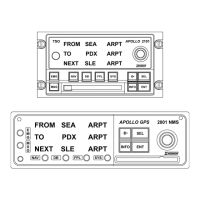
Navigation Displays (continued)
ETE DLS 00:31
à 0.26
FT 00:12 163KTS
ETE
CDI
Flight time since departure is 12
minutes; the ground speed is 163
knots.
ETE DLS 00:31
à 0.26
TRK 164 165
ETE
CDI
The track and bearing indicator.
The track is 164°; the current
bearing to DLS is 165°. The
bearing is displayed to the left or
the right side depending on
whether the aircraft is to the left or
right of the desired course. In this
example, the aircraft is to the right
of the desired course.
ETE DLS 00:31
à 0.26
TRK 164 165
ETE
CDI
The current UTC (Coordinated
Universal Time) is 14:25 (2:25
pm).
ETA DLS 14:56
MIN SAFEA 5700’
ENRTSAFEA 13600’
Estimated Time of Arrival (ETA) at
DLS is 14:56 UTC.
MSA (Minimum Safe Altitude)
MESA (Minimum En route Safe
Altitude)
BARO ALT 390FT
----’ ABOVE HOLD
--:-- TO DESCENT
Barometric (Current) Altitude.
The distance (in feet) above or
below Hold altitude.
Time to beginning of Auto
descent. When Auto Descent has
started, this line displays the
distance (in feet) you are above or
below the glide path.
If the Fuel/Air Data Sensor is installed on the NMS, three additional
pages of navigation information will be available when you turn the
Small knob. See Nav Mode: Navigation Sub-Displays for more
information.
14
[<*Heading_2] Apollo NMS