User Waypoints
User waypoints are waypoints entered and named by you. You may
create a User waypoint at any location by entering Latitude/Longitude
coordinates, or by entering the radial/distance from another waypoint.
If you create a User waypoint by entering a radial/distance, the NMC
will calculate the Latitude/Longitude of the waypoint. You should
understand the use of the Waypoint Retriever before executing
procedures in this section. The waypoint Retriever is described in
DB Mode Procedures, “Retrieving a Waypoint” on page 115.
Creating a User Waypoint by Latitude/Longitude
The following procedure is used to create a User waypoint by entering
latitude/longitude coordinates. If there are already 500 User waypoints, you
must delete a previously entered User waypoint to make room for a new
waypoint. For more information, refer to Operations, Deleting a User
Waypoint.
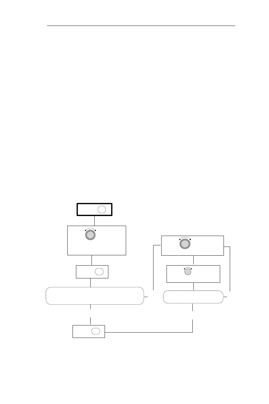
Flow Chart
127
Operations DB Mode Procedures
PRESS DB
BY LAT/LON PAGE
TURN TO DISPLAY
THE CREATE USER WAYPOINT
ENTPRESS
ENTPRESS
IS THE DESIRED WAYPOINT IDENTIFIER, LATITUDE,
LONGITUDE, AND RUNWAY LENGTH DISPLAYED?
TURN TO DISPLAY
THE DESIRED CHARACTER
TURN TO MAKE THE
CHARACTER TO CHANGE FLASH
IS THE DESIRED WAYPOINT
INFORMATION DISPLAYED
NO
YES
NO
YES