SLT12 User Manual
60
Figure 7- 15
7.6
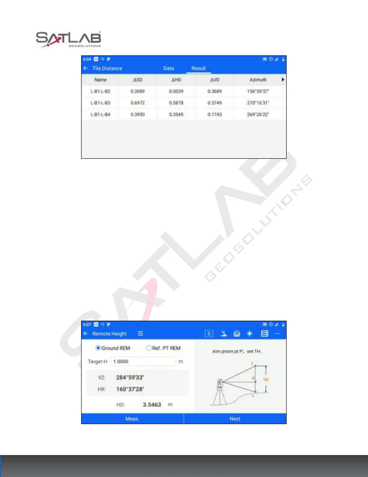
REM
Remote Elevation Measurement is used to directly measure the elevation difference from the overhang point to
the base point where the prism cannot be placed above the base point, divided into ground overhang height and
reference point overhang height. You can enter the Remote Elevation Measurement interface through [Collection]
- [REM].
7.6.1 Ground REM
The ground REM is used to calculate the distance from the target point to the ground, and the target height needs
to be filled in. The operation steps are as follows.
1. The user enters [MLM] and selects "Ground REM". Aim at the target point P, set the target height, and click
[Meas.] to get the angle and distance information. Then click [Next].
Figure 7- 16