SHANGHAI ESURVEY GNSS CO., LTD.
68
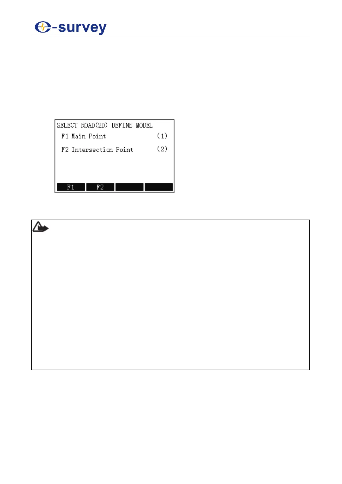
5.2.11.4.1.2 Define Road(2D) Data
It is used to describe and determine road center lines.
There are the following models available for definition of road(2D):
Main point
Intersection point
To define road(2D) data, do the following:
1. To enter SELECT ROAD(2D) DEFINE MODLE display, in ROAD DEFINE display,
press F2 / 2:
2. Select a model:
o Set Main Point
o Set Intersection Point
Note:
When using any of the definition of road (2D), please note the following:
When using intersection point method, please input data successively in
accordance with mileage (small to large) of intersection point. And the first and the
last intersection point should be on the straight line segment of the road centre line.
When using main point method, please do not miss out any main point finally. It's
recommended to input data successively according to mileage magnitude for check
and verification.
The datum input with main point method cannot be viewed and edited in the form of
intersection point method. But the datum input with intersection point method can
be viewed and added in the form of main point, except for deletion.
Affected by precision of turn angle, deviation may exists in main point datum
converted by intersection point datum.
No matter what kind of method you use, at least two valid main points or
intersection points are required for normal staking out and measuring.
No matter what kind of method you use, its maximum mileage should not be greater
than 4294000.000m (i.e. K4294+000.000m).