SHANGHAI ESURVEY GNSS CO., LTD.
70
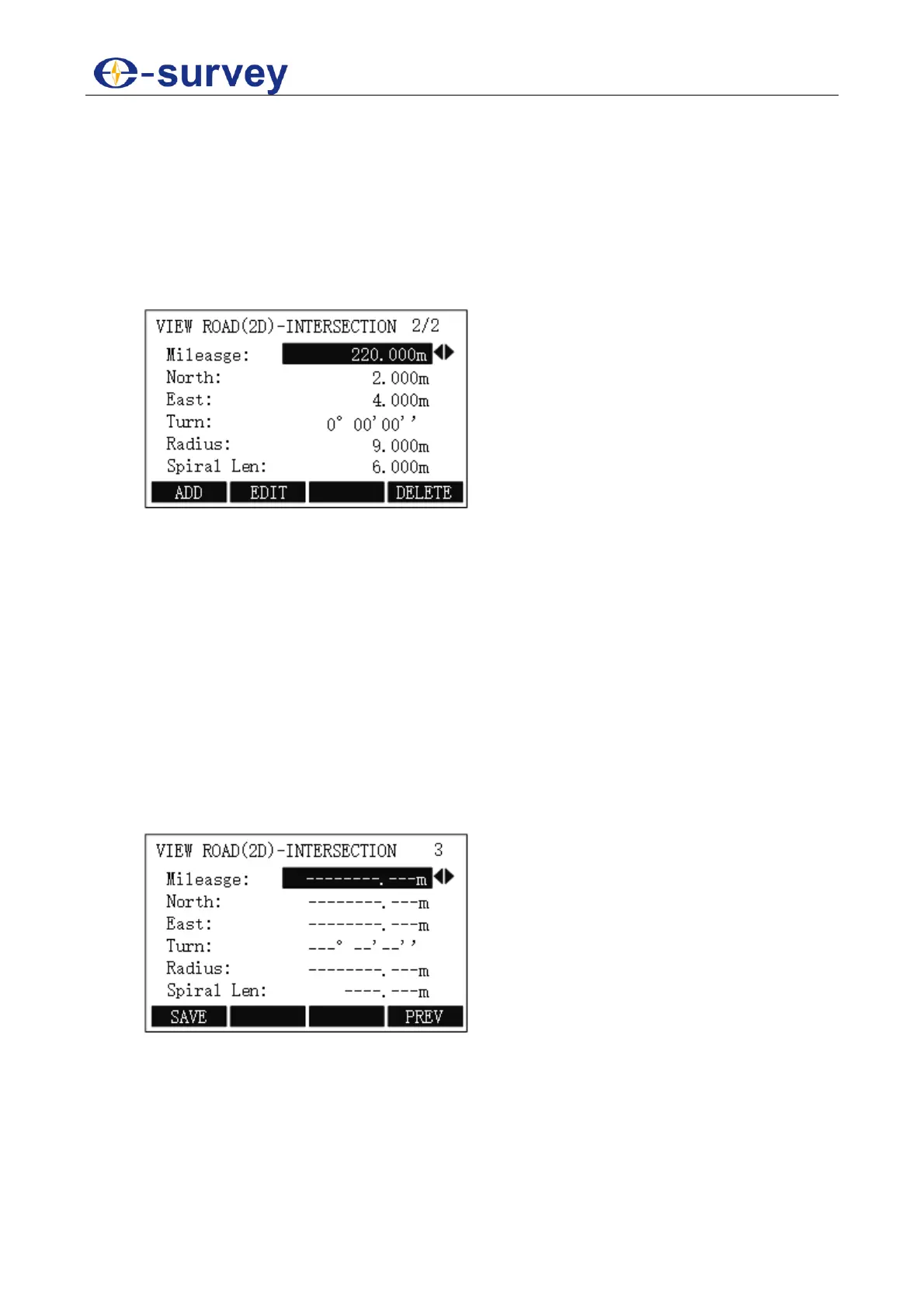
5.2.11.4.1.2.2 Set Intersection Point
It is used to describe the entire road with information of intersection point of the route. This
method is appropriate for the line type whose intersection points are symmetrical (i.e. their
corresponding tangent lines are equilong), and start point and end point of the route are on
the straight line segment or its vertex points.
To set intersection point, do the following:
1. To select Intersection Point, in SELECT ROAD(2D) DEFINE MODLE display,
press F2 / 2:
o Mileage: the stake mark of intersection point.
Certain characters K, k and +” etc. cannot be contained. e.g. K2+224.224
should be input as 2224.224.
o North: the ordinate of the intersection point.
o East: the abscissa of the intersection point.
o Turn: the turn angle of an intersection point relative to the route. Turn angles
of start point and end point should be set to 0.
o Radius: the radius of curvature of circular curve corresponding to
intersection point. When the route turns left, the radius will be negative; when
the route turns right, it will be positive. At the start point and end point of
route, the value should be set to 99999999.999 or -99999999.999.
o Spiral Len: the easement curve length relevant to the intersection point.
Please set it to 0 when there is no easement curve.
2. To modify data, press F2 EDIT.
3. To add a new intersection point, press F1 ADD, input data:
4. Optional: To delete the current displayed intersection point and other intersection
points whose mileage is larger than the current one, press F4 DELETE.