SHANGHAI ESURVEY GNSS CO., LTD.
69
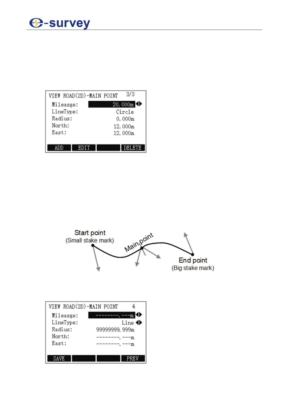
5.2.11.4.1.2.1 Set Main Point
Utilizing main point information relative to the line to describe the entire road, it is the key
point where the line type changes along with the line. It is used to solve any complicated
line type including ramp.
To set main point, do the following:
1. To select Main Point, in SELECT ROAD(2D) DEFINE MODLE display, press F1 /
1:
o Mileage: the stake mark of main point on the road centre line.
Certain characters K, k and +” etc. cannot be contained. e.g. K2+224.224
should be input as 2224.224.
o LineType: the line type of route preceding main point (big stake mark
direction), including line, circle (round curve), spiral (easement curve) and
end point.
o Radius: the radius of curvature of one side preceding main point (big stake
mark direction), except the end point of route. When the route turns left, the
radius will be negative; when the route turns right, it will be positive. When
the radius of curvature is infinite, the value should be set to 99999999.999 or
-99999999.999.
o North: the ordinate of the main point.
o East: the abscissa of the main point.
2. To modify data, press F2 EDIT.
3. To add a new main point, press F1 ADD, input data:
4. Optional: To delete the current displayed main point, press F4 DELETE.