3─117
[1] Land Marks
• Sets whether or not the Land Marks are displayed.
• Each time you press [8] key, the Land Marks is switched
between ON and OFF.
• ON: Displayed
OFF: Not displayed
[2] Rivers and Lakes
• Sets whether or not the Inland waters are displayed.
• Each time you press [8] key, the Rivers and Lakes is
switched between ON and OFF.
• ON: Displayed
OFF: Not displayed
[3] Cultural Features
• Sets whether or not the cultural features are displayed.
• Each time you press [8] key, the Cultural features is switched
between ON and OFF.
• ON: Displayed
OFF: Not displayed
[4] Sea bottom types
• Sets whether or not the types of the seabed are displayed.
• Each time you press [8] key, the Sea bottom type is switched between ON and OFF.
• ON: Displayed
OFF: Not displayed
[5] Under water rocks etc.
• Sets whether or not the rocks, obstructions etc are displayed.
• Each time you press [8] key, the Under water is switched between ON and OFF.
• ON: Displayed
OFF: Not displayed
[7] Depth Contours.
• Sets the Depth Contours settings.
• Press [8] key. the Depth Contour setting menu appears.
6.
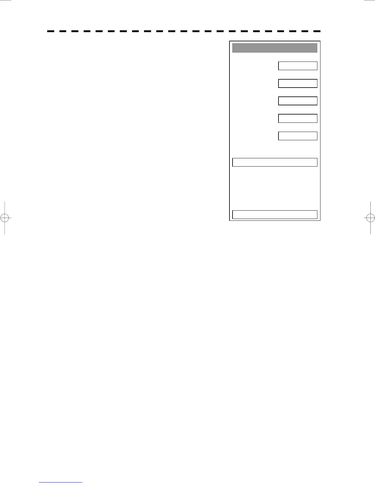
C-MAP Setting
2. River and Lake
ON
3. Cultural
ON
4. Bottom Type
ON
5. Under Water
7. Depth Contour >
0. EXIT
1. Land Marks
ON
ON

 Loading...