JMA-9100 Instruction Manual > 3.BASIC OPERATION > 3.5 USE OWN SHIP'S TRACK
3-39
3
3.5 USE OWN SHIP'S TRACK
The own ship's track function saves and displays own ship's track.
If navigation equipment is connected, this radar system records latitude/longitude
data sent from the navigation equipment and displays own ship's track.
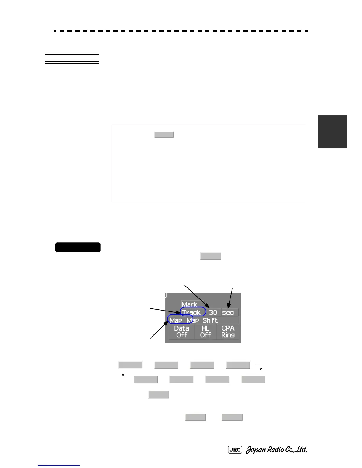
3.5.1 Display Own Ship's Track (Display Own Track)
Procedures
1) Left-click the Own Track Color button located at the
lower right of the display.
The color of the own ship's track are switched.
→ → →
← ← ←
2) Left-click the button located at the lower right of the
display.
The map display function is turned on or off .
When Color is selected, the own ship's track is displayed.
NOTE:
Even when own ship's track storage interval is turned
, own ship's track can be displayed. However, in this
case, if rewrite operation such as changing of the display
range is performed for the radar display, own ship's track
display is erased and the track will not be plotted again.
If the own ship track display is turned off when own ship
track is in storage, own ship's tracks are not shown on the
radar display, but own ship's track is still saved.
The own ship's track function is available between latitudes
of 85°N and 85°S.
Off
Track
Own Track Interval
Map On/Off
Own Track Color
Own Track Interval Unit
Off
White Gray Blue
Red Pink Yellow Green
Map
Map Map
 Loading...