EFD1000 PFD Pilot’s Guide
CHAPTER 4, REFERENCE GUIDE
EFD1000 PFD Pilot’s Guide
EFD1000 PFD Pilot’s Guide Page 4-27A-01-184-00 REV B
2
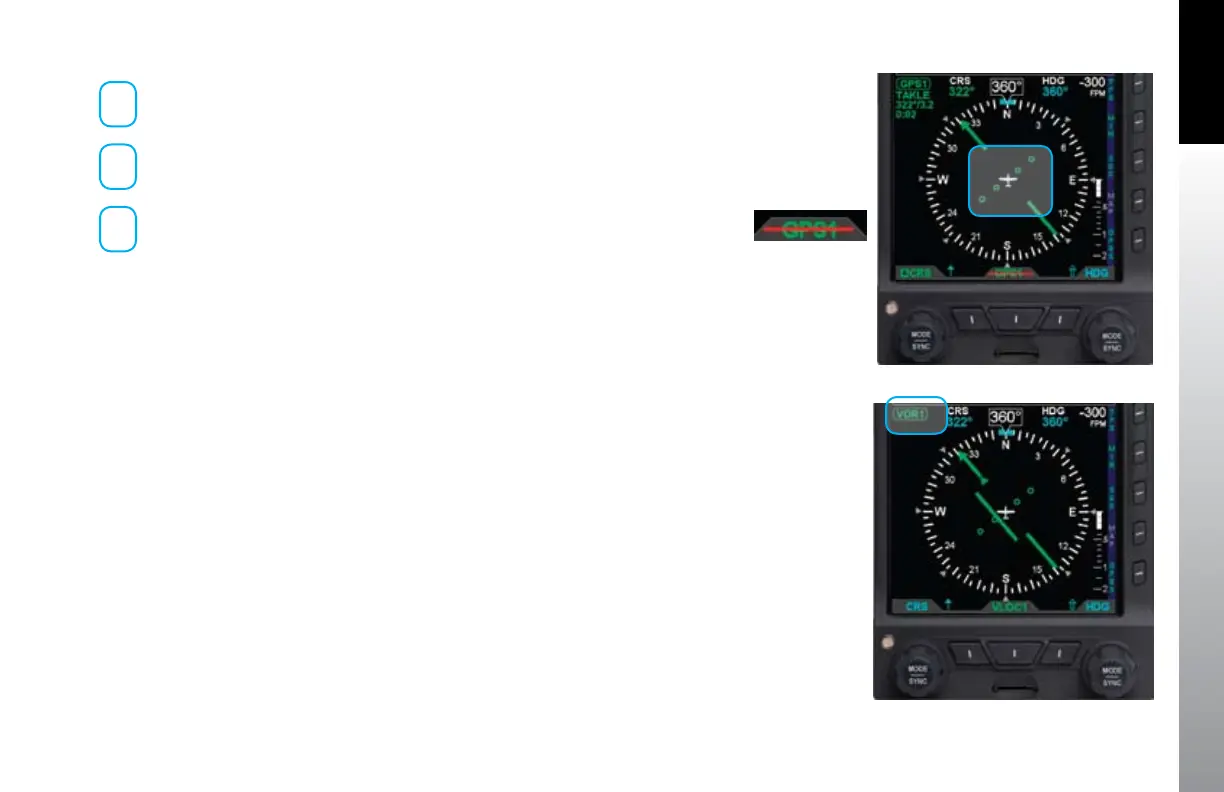
Waypoint identier or tuned frequency (when available)
3
Bearing (in degrees)/Distance (in Nautical Miles) to waypoint or
navaid (when available)
4
Estimated Time En route (Hours:Minutes)
When both the navigation source identier and the tuned frequency of the associated
VHF NAV radio are available, only the source identier information shall be displayed on
the second line of the information block.
When available, the bearing and distance to station is displayed on the third line of the
information block in the format dddº/nnnn or dddº/nn.n, where ddd is the bearing in
degrees and nnnn or nn.n is the distance in nautical miles (e.g. 360º/1103 or 322º/3.2
shown in Figure 4-58). The distance to waypoint is displayed as follows:
Distance to waypoint < 100 NM, display is in tenths of a mile, i.e. ##.#.•
Distance to waypoint is 100 - 9999 nm, display in whole miles, i.e. ####.•
Distance to waypoint is > 9999 NM, display is dashed, i.e. ----.•
When available, the estimated time en route information shall be displayed on the
fourth line of the information block in the format h:mm (where h is hours and mm is
minutes).
When CDI navigation source data is invalid or not available from a congured
navigation source, the HSI course deviation bar and the FROM/TO indication are
removed from the display (Figure 4-58). Additionally, the selected CDI Navigation
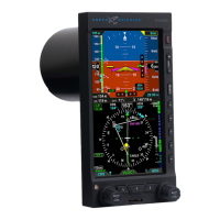
Source label is slashed with a red line (Figure 4-59).
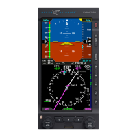
When information for a congured and selected navigation source is not available or
invalid, the source information block is blank (Figure 4-60).
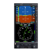
Figure 4-58 No Course Deviation Bar or FROM/TO Info
Figure 4-59
Invalid CDI Navigation
Source Label
Figure 4-60 Blank Info Block Fields