Viva Series, Roads - General 1192
43.7.6 Road - Working Corridor
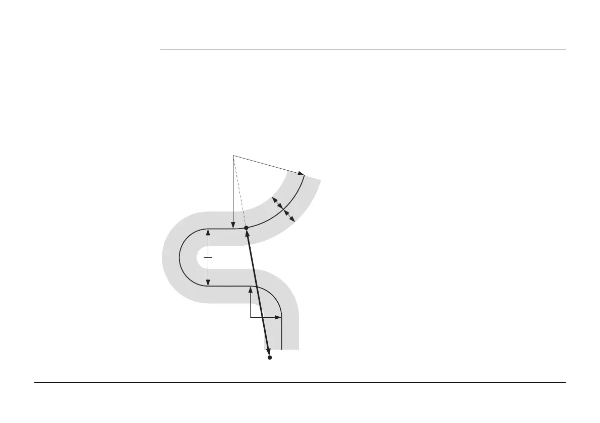
Description A working corridor defines the valid offset range left and right of the centreline. When
working with irregular alignments such as traffic islands and parking lots, working corridors
are useful to avoid displaying results from the wrong centreline element.
The following example shows the result if working without a defined working corridor. For
the measured position (b), the application finds the centreline point (c) with the minimum
perpendicular offset (f).
With a defined working corridor (e), the application would display a message advising that
the measured position is outside of the defined centreline.
a) Centreline
b) Measured position
c) Projected point on the centreline
d) Defined offset range for the working corridor
e) Working corridor
f) Offset from the centreline, if no working corridor is
used
a
b
e
e
f
c
d
d
Road_081