Viva Series, Reference Line 977
41.4.4 Defining Reference Line/Arc Slopes
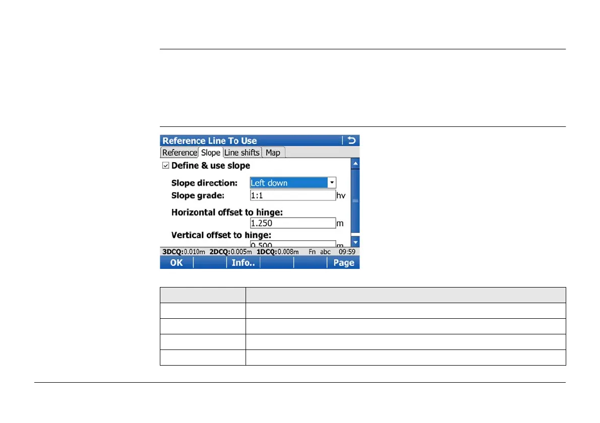
Description It is possible to measure points and stake points on slopes related to a reference line/arc.
A slope can be defined and cut/fill values can then be displayed to the slope when measuring
along the reference line/arc. The slope is a plane from the reference line/arc and extends
along the length of the reference line/arc.
Slopes can be used when, measuring to a reference line/arc, staking a point relative to a
reference line/arc, or performing a grid stakeout relative to a reference line/arc.
Reference Line To Use/
Reference Arc To Use,
Slope page
Key Description
OK To confirm the selections and to return to the previous screen.
Info.. To edit the screen page which will be displayed for slopes.
Page To change to another page on this screen.
Fn Config.. To configure the Reference Line application.


 To Next Page