Viva Series, Stakeout 1548
50 Stakeout
50.1 Overview
Description The Stakeout application is used to place marks in the field at predetermined points. These
predetermined points are the points to be staked. The points to be staked can
• be uploaded to a job on the instrument using LGO.
• already exist in a job on the instrument.
• be uploaded from an ASCII file to a job on the instrument using Main Menu: Jobs &
Data\Import data\Import ASCII data.
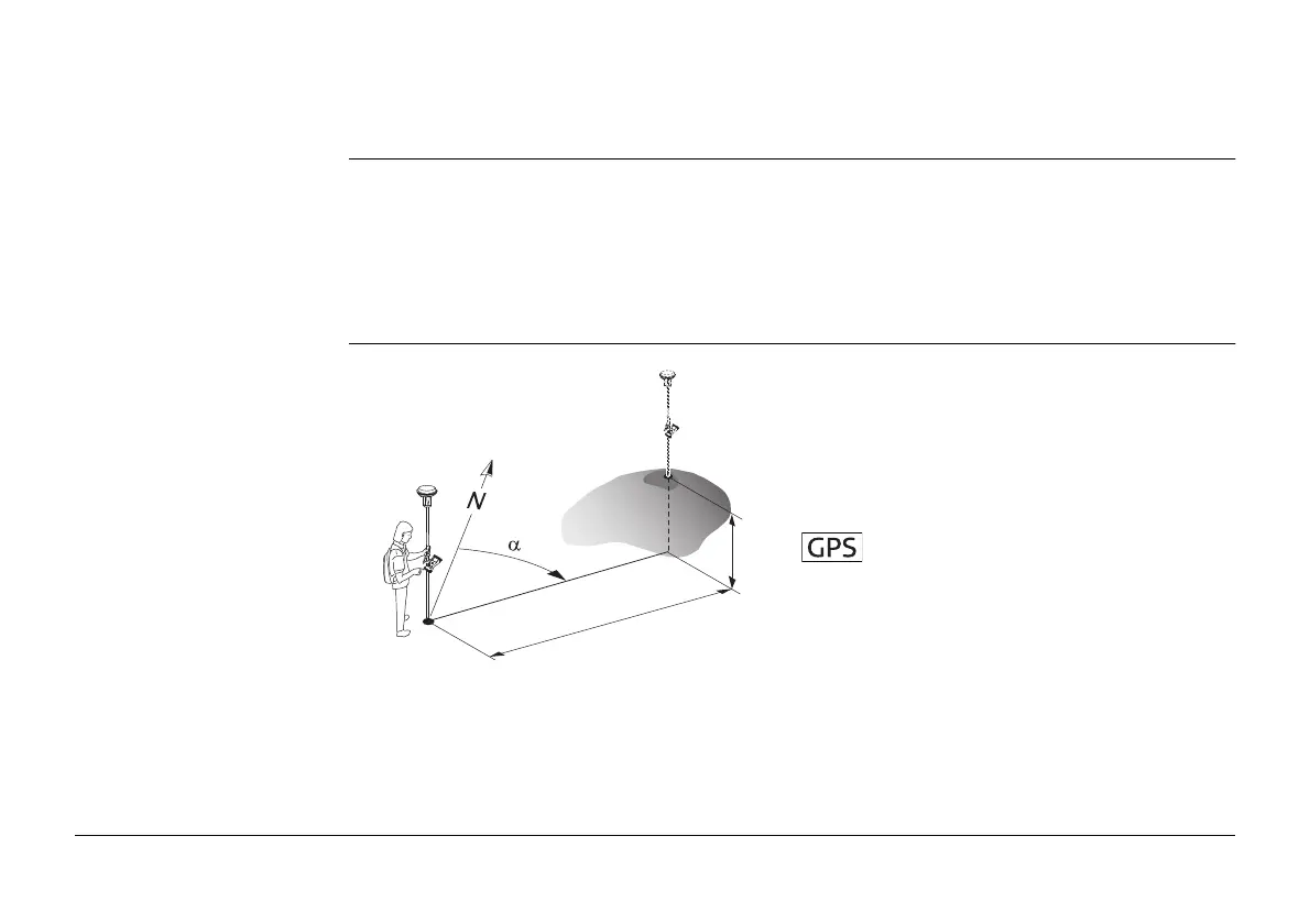
Diagram
P0 Current position
P1 Point to be staked
d1 Stake out distance
d2 Height difference between current posi-
tion and point to be staked
α Stake out direction
d1
P1
P0
d2
GS_057
 Loading...