Viva Series, Roads - Alignment Editor 1215
44 Roads - Alignment Editor
44.1 Basic Terms
Description A road surface can be thought of three different types of design elements:
• the horizontal alignment
• the vertical alignment
• the cross section
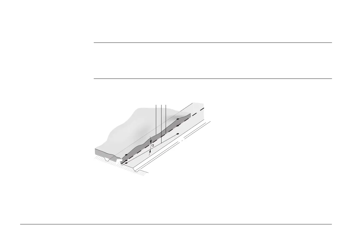
Basic concepts
Any point A in a project has ENH coordinates in a determined coordinate system. Each point
has three different positions:
• A’ - Point on real surface
• A’’ - Point on horizontal alignment
• A’’’- Point on vertical alignment
a - Natural surface.
b - The vertical alignment.
c - The horizontal alignment.
A’’/B’’ - Points on horizontal alignment
A’/B’ - Points on real surface
A’’’/B’’’ - Points on vertical alignment
TS_051
A’
A’’’
B’
B’’
abc
A’’
B’’’
 Loading...