Viva Series, Roads - General 1107
43.3.2 Road Stringline - Info Page
Description This info page is used for staking and checking Road stringlines.
Available fields
The following parameters are available. All fields are display only.
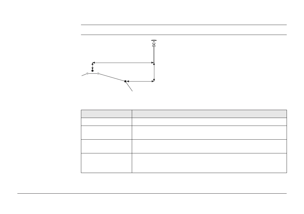
a) Stringline to stake out
b) Centreline
c) Strgl offset
d) Strgl ht diff
e) CL offset
f) CL ht diff
Field Description
Strgl task Name defined for the stringline task.
∆ offset Horizontal offset between the defined position and the current
position.
∆ height Vertical offset between the defined position and the current posi-
tion.
∆ chainage Difference between the defined chainage Stake chainage on the
General page and the current chainage Chainage shown on the
Stake page.
a
f
b
d
e
c
Road_043