Viva Series, Roads - Road 1302
45.2.3 Advanced Slope Settings
Access Press Slope in the Define screen.
General slope stakeout Description
This method involves a generic approach to slope stakeout for direct stakeout of the catch
point. No special batter rails or reference point parameters are defined.
Workflow
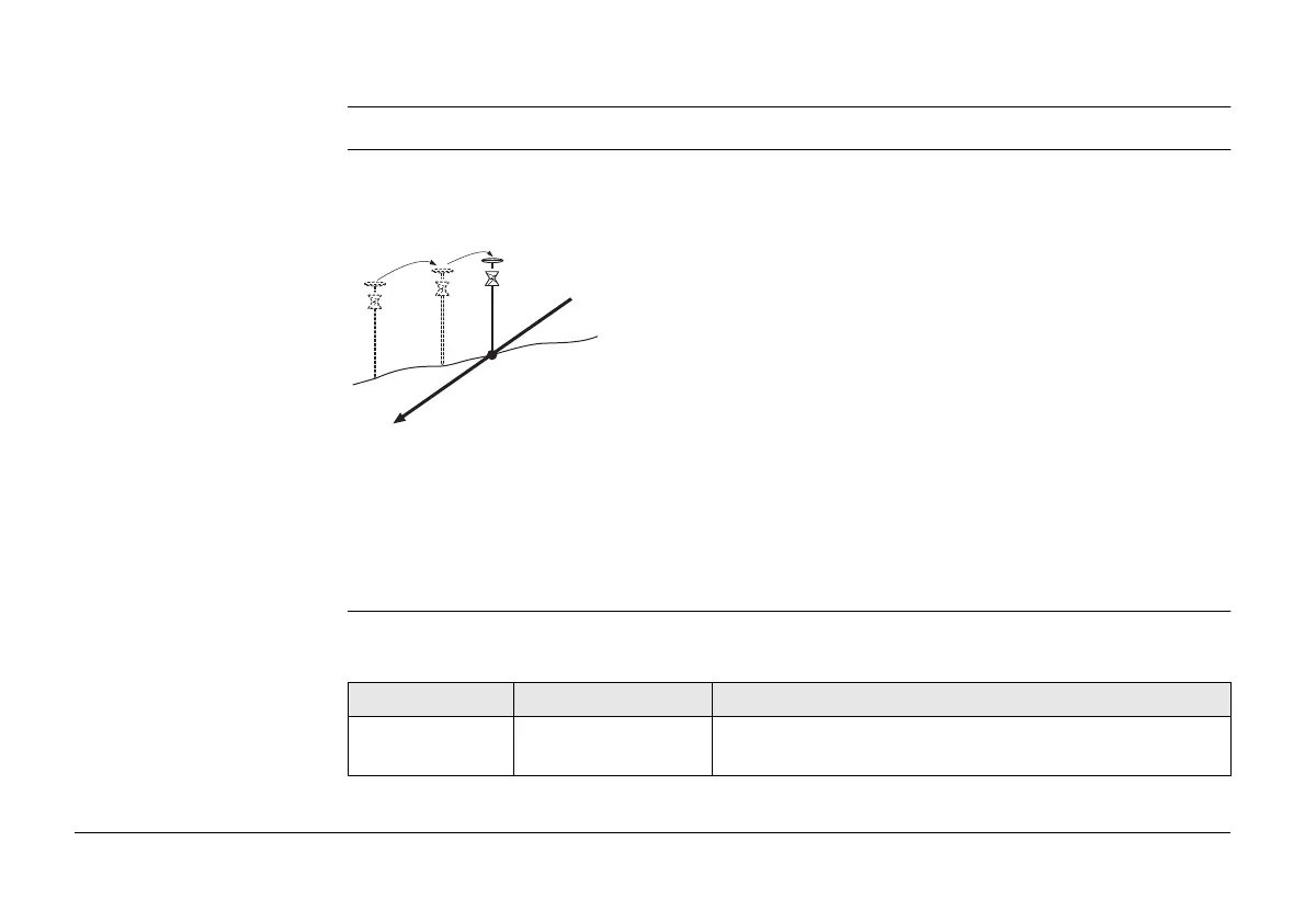
As the natural surface is unknown the catch point can only be staked out iteratively. If
staking out on a horizontal natural surface, the values shown for ∆ offset indicates how far
the catch point is away. If the natural surface is not horizontal, more iterations could be
needed.
Slope Stakeout Settings Description of fields
Common to all types
a) Slope to stake out
b) Natural surface
c) Catch point
a
c
b
Road_055
Field Option Description
Use advanced
slope stakeout
Check box When this box is checked, slope stakeout settings are
available.