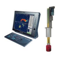
SimradSX90
DPTDepth
Thistelegramcontainswaterdepthrelativetothetransducer
andoffsetofthemeasuringtransducer.Positiveoffsetnumbers
providethedistancefromthetransducertothewaterline.
Negativeoffsetnumbersprovidethedistancefromthetransducer
tothepartofthekeelofinterest.
$--DPT,x.x,y.y,z.z*hh<CR><LF>
•DPT=telegramidentier
•x.x=waterdepth,inmeters,relativetothetransducer
•y.y=offset,inmeters,fromthetransducer
•z.z=maximumrangescaleinuse
Foradditionaldetails,refertotheNMEAstandard.
GGAGlobalpositioningsystemxdata
Thistelegramcontainstime,positionandxrelateddatafroma
globalpositioningsystem(GPS).
$--GGA,hhmmss.ss,llll.ll,a,yyyyy.yy,a,
x,zz,d.d,a.a,M,g.g,M,r.r,cccc*hh<CR><LF>
•GGA=telegramidentier
•hhmmss.ss=coordinateduniversaltime(UTC)ofposition
•llll.ll,a=latitudenorth/south,positionindegrees,minutes
andhundredths.CharactersN(North)orS(South)identies
thebearing.
•yyyyy.yy,a=longitudeeast/west,positionindegrees,minutes
andhundredths.CharactersW(West)orE(East)identies
thebearing.
•x=GPSqualityindicator(refertotheNMEAstandardfor
furtherdetails)
•zz=numberofsatellitesinuse,00to12,maybedifferent
fromthenumberinview
•d.d=horizontaldilutionofprecision
•a.a,M=altituderelatedtomeansealevel(geoid)inmeters
•g.g,M=geoidalseparationinmeters
•r.r=ageofdifferentialGPSdata
•cccc=differentialreferencestationidentication,0000to
1023
222
307531/C

 Loading...