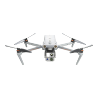
Chapter 6 Autel Enterprise App 121
Table 6-6 Attitude Ball Details
1
Remaining Flight
Time of the
Displays the current remaining battery level and estimated
remaining flight time of the aircraft.
2 MSL Altitude
Refers to the current altitude of the aircraft relative to the mean
sea level (MSL).
3 Aircraft Position
Displays the current position of the aircraft, which can help you
observe the approximate position between the aircraft and the
4 Aircraft Heading
Displays the current nose orientation of the aircraft. If the
aircraft is no longer visible in the line of sight, the aircraft can be
controlled to return to the home point based on the position
and heading of the aircraft.
Displays the current gimbal orientation of the aircraft.
6 Vertical Altitude
Refers to the current vertical altitude of the aircraft relative to
the take-off point.
Refers to the current vertical flight speed of the aircraft.
8
Remote Controller
Location
Displays the current position of the remote controller, which can
help you observe the approximate position between the aircraft
and the remote controller.
Refers to the set home point of the aircraft.
10
Distance
Refers to the current horizontal distance from the aircraft to the
take-off point.
Refers to the current horizontal flight speed of the aircraft.
12 Aircraft Battery
Displays the real-time remaining battery level of the aircraft in
the dynamic circular battery bar.
"Map" Interface
On the main interface of the Autel Enterprise App, tap the “ ” icon in the corner of the "Map"
preview interface, or tap the "Map" mini window in the lower-left corner after entering the "Zoom
Camera" interface, “Thermal Camera” interface, or "Wide Angle Camera" interface, to enter the
"Map" full-screen interface.