1.
Disconnect the GNSS antenna from the VersaSync unit (this is required only when san-
itizing the unit).
2.
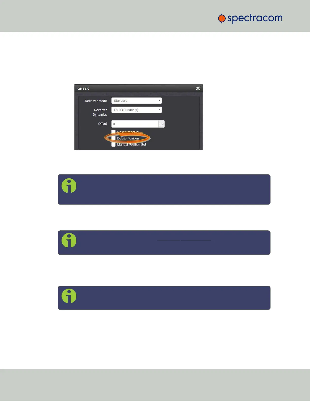
Navigate to Interfaces > References: GNSS Reference.
3.
Click on the GEAR button next to the GNSS Reference (typically, there is only one ref-
erence, numbered "0"). The GNSS0 window will open:
Locate the Delete Position box, check it, and click Submit.
4.
VersaSync will initiate a GNSS self survey.
Note: In Mobile Receiver Mode it is NOT possible to delete the position and start
the GNSS survey. This feature is only available in Standard Mode and in Single
Satellite Mode. In Single Satellite Mode a GNSS survey may take up to 24 hours.
3.3.3.9 Manually Setting the GNSS Position
Note: This topic applies only to stationary applications, i.e. to Standard mode,
or Single Satellite mode.
The exact geographic position (location and elevation) of the antenna your VersaSync unit—
and thus its onboard GNSS receiver—is a major factor for VersaSync to calculate an accurate
System Time from the GNSS reference.
Note: The elevation (altitude) should be set in accordance with the World Geo-
detic System 1984 (WGS84), not Mean Sea Level (MSL).
Normally, the onboard GNSS receiver will track and adjust the antenna position during the so-
called GNSS self survey, which is performed during initial commissioning of a VersaSync unit,
or when rebooting a unit after it had been powered down for some time ("cold start").
162
CHAPTER 3 • VersaSync User Manual Rev. 6.0
3.3 Managing References