12-35
12. GPS OPERATION (ADVANCED)
GPS SET
»
GPS > GPS TX Mode > D-PRS
> TX Format > Object
Object Name
Enter an Object name of up to 9 characters.
Data Type (Default: Live Object)
Sets the Object’s status.
• Live Object: The Object is valid.
• Killed Object: The Object is invalid.
Symbol (Default: Radio)
The symbol is an icon that indicates the Object’s
means of transportation or location. The saved
symbol is transmitted along with the position data
while in the D-PRS mode.
LSee page 12-32 for details of editing a symbol.
Comment
Enter a comment to transmit it with the D-PRS
position data.
The number of characters you can enter differs,
depending on the Data Extension and Altitude
data entry.
Data Extension Altitude
Characters
entered
(maximum)
OFF — 43 (Default)
OFF Entered 35
Course/Speed — 36
Course/Speed Entered 28
Power/Height/Gain/Directivity
— 36
Power/Height/Gain/Directivity
Entered 28
The symbol “ ” displays the transmittable
comment range. Please note that the characters
that exceed the range will not be transmitted.
Transmittable comment range display
(Example: up to 28 characters)
Position
Displays the position information of the Object.
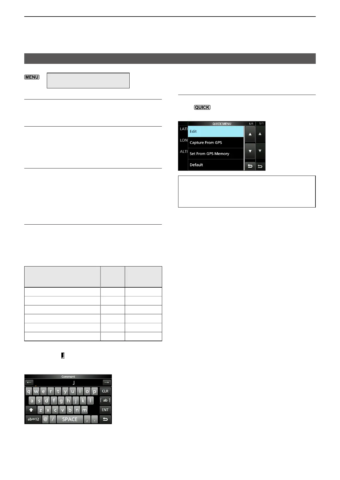
Push
to open the QUICK MENU screen
shown below.
TIP: When you select “Capture From GPS”
or “Set From GPS Memory,” you can capture
the position from the GPS, or set the Object’s
position from the GPS memory.
Entering the position information manually
1. Touch “Edit” on the QUICK MENU screen.
• The POSITION EDIT screen is displayed.
2. Touch “LATITUDE.”
3. Enter a latitude.
LTouch “N/S” to switch the north latitude and the
south latitude.
4. Touch [ENT].
5. Touch “LONGITUDE.”
6. Enter a longitude.
LTouch “E/W” to switch the east longitude and
the west longitude.
7. Touch [ENT].
8. Touch “ALTITUDE.”
9. Enter an altitude.
L
10. Touch [ENT].
11. Touch “<<Write>>.”
12. Touch [YES].
• The position information is entered.