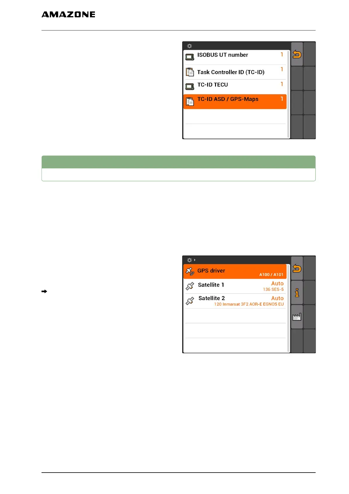
If an implement is connected to the ASD interface,
the TC-ID ASD/GPS maps defines where the
incoming data should be sent. To be able to use the
ASD interface and GPS maps, the TC-ID ASD/GPS
maps must match with the Task Controller ID
5. Under "TC-ID ASD/GPS maps", enter the
identification number for the ASD interface and
GPS maps.
7.3
GPS configuration
7.3.1
Setting up the A100/A101 receiver
This GPS receiver provides the option of setting both
correction satellites manually. The correction
satellites send correction data to the receivers. The
correction data increase the accuracy.
1. Select "GPS driver" > "A100/101".
2. Under "Satellite 1" and "Satellite 2", select "Auto".
With the "Auto" setting, the GPS receiver
automatically searches for the correct satellites.
7.3.2
Setting up the AG-STAR receiver
This GPS receiver can be operated with different
configurations. The configurations differ in terms of
the satellite system and correction satellites. The
GPS receiver can be adjusted according to the region
and availability of correction services.
CMS-T-00000268-A.1
CMS-T-005811-B.1
CMS-T-005816-B.1
7 | AMATRON 3 configuration
GPS configuration
MG5560-EN-II | E.1 | 21.04.2020
25