Falcon M-Class | User Guide
212
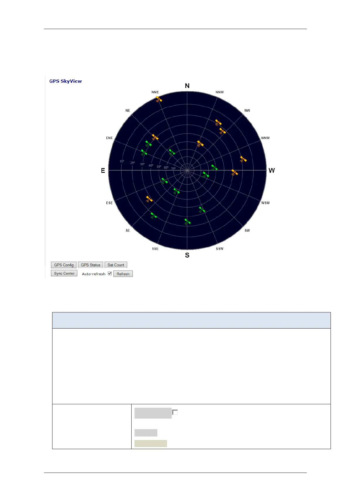
4.14.8 Sky View
This section displays the current sky map of the GPS receiver tracked satellites.
Figure 4-119: Sky view display
Table 4-115: Sky View parameters
Displays the sky view of the tracked satellites.
The azimuth angle is the angle between the North ('N') and radial on which the satellite is displayed.
The elevation angle is represented by the distance from the center (90 degrees) to the edge of the sky map circle
(0 degrees).
Each satellite icon is positioned according to current status and displayed in green (strong receive signal) or
orange (fair signal).
When pointing on a satellite a text box balloon will automatically open, showing satellite info highlights.
Auto-refresh : Check this box to enable an automatic refresh of the
page at regular intervals.
Refresh
GPS Status , GHPS Config, Sat Count, Sync Cent:direct links
 Loading...