Cockpit Reference Guide for the Cirrus SR2x with Perspective Touch+ by Garmin
190-02954-01 Rev. A
132
Hazard Avoidance
Flight
InstrumentsEIS
Nav/Com/
XPDR/Audio
Flight
Management
Hazard
AvoidanceAFCS
Additional
FeaturesAnnun/AlertsAppendixIndex
Flight
InstrumentsEAS
Audio and
CNS
Flight
Management
Hazard
AvoidanceAFCS
Additional
Features
Abnormal
OperationAnnun/AlertsAppendixIndex
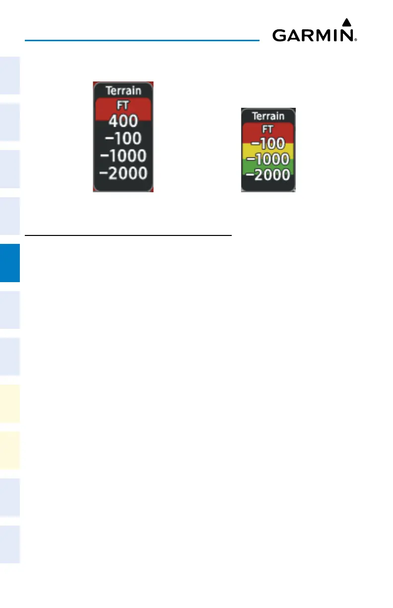
Relative Terrain Legend
In-Air Legend
On-Ground Legend
DISPLAYING RELATIVE TERRAIN INFORMATION
Showing the Terrain Pane:
From MFW Home, touch the [Terrain] Button. [Terrain] can be Terrain-SVT, or TAWS.
Enabling/disabling aviation information on the Terrain Pane:
1) From MFW Home, touch the [Terrain] Button. [Terrain] can be Terrain-SVT, or TAWS.
2) Touch the Show Aviation Data Button to enable/disable aviation information (airports,
VORs, NDBs, Intersections) for the terrain pane.
Relative Terrain on the Navigation Maps
Controlling Relative Terrain Information (Navigation Map Panes):
1) From MFW Home, touch Map > Map Selection > Map Settings.
2) If not selected, touch the Sensor Tab.
3) Touch the Terrain Button.
4) Touch the Relative Button to enable Relative Terrain, or Off to remove terrain
information.
Controlling Relative Terrain Information (Inset and HSI Map):
1) From PFW Home, touch PFD Map Settings.
2) If the Inset Map or HSI Map is not presently shown on the PFD, do the following:
a) Touch the Layout Button.
b) Touch the Inset Map Button to display the Inset Map, or touch the HSI Map Button
to display the HSI Map.
3) Touch the Terrain Button.
4) Touch the Relative Button to enable Relative Terrain, or Off to remove terrain
information.
Or: