Cockpit Reference Guide for the Cirrus SR2x with Perspective Touch+ by Garmin
190-02954-01 Rev. A
Appendix
286
Flight
InstrumentsEIS
Nav/Com/
XPDR/Audio
Flight
Management
Hazard
AvoidanceAFCS
Additional
FeaturesAnnun/AlertsAppendixIndex
Flight
InstrumentsEAS
Audio and
CNS
Flight
Management
Hazard
AvoidanceAFCS
Additional
Features
Abnormal
OperationAnnun/AlertsAppendixIndex
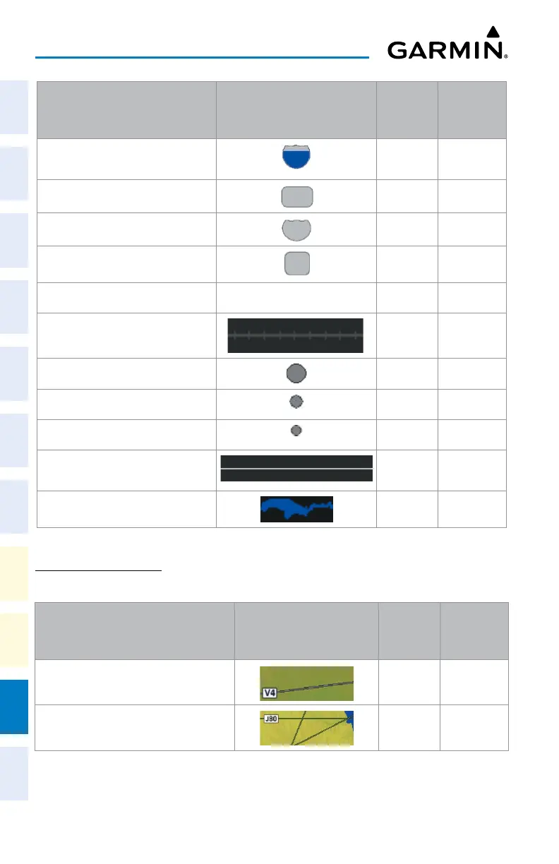
Land Symbols Symbol
Default
Range
(nm)
Maximum
Range
(nm)
- Interstate Highway (Freeway)
50 400
- International Highway (Freeway)
15 150
- US Highway (National Highway)
15 150
- State Highway (Local Highway)
10 100
- Local Road (Local Road) N/A
4 25
- Railroad
7.5 25
Large City (> 200,000)
100 1000
Medium City (> 50,000)
50 400
Small City (> 5,000)
25 100
State/Province
750 1000
Rivers and Lakes (River/Lake)
75 100
Land Symbol Information
AVIATION SYMBOLS
The following items are configured on the Aviation Tab of the 'Map Settings' Screen.
Aviation Symbols Symbol
Default
Range
(nm)
Maximum
Range
(nm)
Low Altitude Airways (V and T Routes) 50 100
High Altitude Airways (J and Q Routes) 50 100