Cockpit Reference Guide for the Cirrus SR2x with Perspective Touch+ by Garmin
190-02954-01 Rev. A
Appendix
287
Flight
Instruments EIS
Nav/Com/
XPDR/Audio
Flight
Management
Hazard
Avoidance AFCS
Additional
Features Annun/Alerts Appendix Index
Flight
Instruments EAS
Audio and
CNS
Flight
Management
Hazard
Avoidance AFCS
Additional
Features
Abnormal
Operation Annun/Alerts Appendix Index
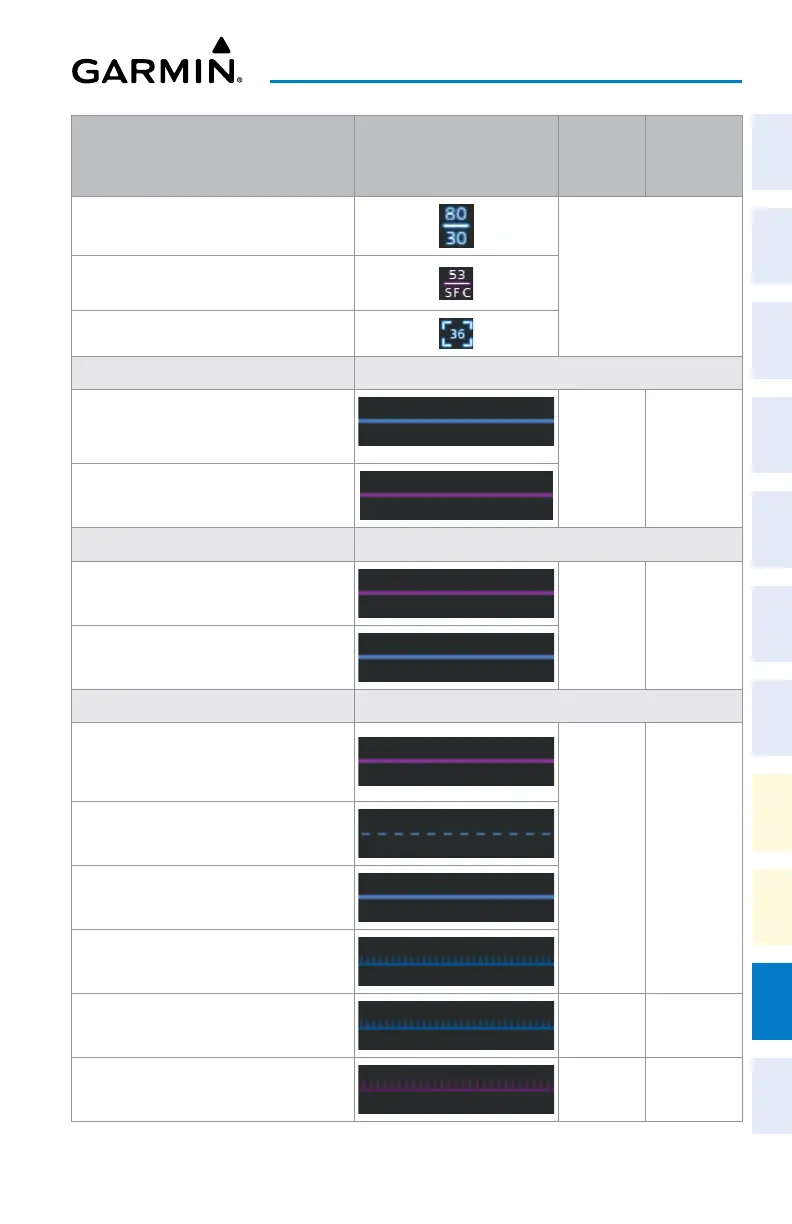
Aviation Symbols Symbol
Default
Range
(nm)
Maximum
Range
(nm)
Class B Airspace Altitude Label (ceiling/
floor)
Label placement and
ranges are variable, in
order to provide the
best representation and
minimal clutter
Class C Airspace Altitude Label (ceiling/
floor)
Class D Airspace Altitude Label (ceiling)
CL B/TMA/AWY (see below)
- Class B (CL B) and Terminal
Maneuvering Area (TMA)
1
50 150
- Airway (AWY)
1
CL C/CTA (see below)
- Class C Airspace (CL C)
50 100
- Control Area (CTA)
1
CL A/D (see below)
- Terminal Radar Service Area (TRSA),
Controlled Traffic Region (CTR)
1
, and
Class A (CL A)
1
10 100
- Class D
- Aerodrome Traffic Zone (ATZ)
1
- Traffic Information Zone (TIZ)
1
Restricted and Prohibited Areas (Restricted) 50 100
Military Operations Areas (MOA (Military)) 50 250