41
98-05273-EN R7
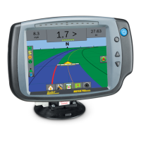
MATRIX
®
Pro 570GS
•
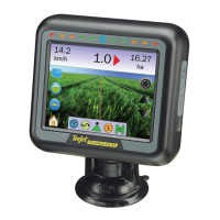
MATRIX
®
Pro840GS
HOMESETUPGUIDANCE FULL SCREENIMPLEMENT INTRODUCTIONRATE CONTROLAPPENDIX GNSS
GNSS Precise point positioning (PPP)
PPP is a subscription based globally provided satellite correction
service broadcast to properly equipped GNSS receivers. PPP
utilizes a global array of reference stations to correct for satellite
clock and orbit errors which are then broadcast to local receivers.
PPP does require a convergence time.
GNSS (Global navigation satellite system):
A general term that refers to a multiple satellite navigation system
used by a receiver to compute its position. Examples of these
systems include: GPS developed by the United States and
GLONASS by Russia. Additional systems in development include
Galileo by the European Union and Compass by China. New
generation GNSS receivers are being designed to utilize multiple
GNSS signals (such as GPS and GLONASS). Depending on
constellation and desired accuracy levels, system performance
may be improved by having access to a greater number of
satellites.
GPS (Global positioning system):
The name of the satellite-navigation network maintained by the
U.S. Department of Defense. It is composed of approximately 30
satellites which continuously orbit the earth. The term is also used
to refer to any device that depends on navigation satellites for
functionality.
NTRIP (Networked transportation of RTCM via
internet protocol):
An internet-based application that makes the RTCM correction
data from the CORS stations available to anyone with an internet
connection and the appropriate log-on credentials to the NTRIP
server. Typically uses a cellular link to get to the internet and the
NTRIP server.
Positional drift
The constant change in the GNSS position calculation primarily
caused by atmospheric and ionospheric changes, poor satellite
geometry (possibly caused by obstructions such as buildings and
trees, satellite clock errors and satellite constellation changes. For
sub-decimeter accuracy dual frequency receivers using either PPP
or RTK solutions are recommended.
RTK (Real time kinematic):
Currently the most accurate GPS correction system available that
uses a land-based reference station located in relatively close
proximity to the GPS receiver. RTK can provide one-inch, also
known as centimeter, pass-to-pass accuracy and also provides
year-to-year position stability. RTK users can have their own base
stations, subscribe to RTK Networks or use CORS.
SBAS (Satellite based augmentation system):
A general term that refers to any satellite-based differential
correction system. Examples of SBAS include: WAAS in the
United States, EGNOS in Europe and MSAS in Japan. Additional
SBAS covering other regions of the world will likely be coming
online in the future.
WAAS (Wide-area augmentation system):
A satellite correction service developed by the Federal Aviation
Administration (FAA). It is free to use and provides coverage
across the U.S. along with parts of Canada and Mexico. WAAS
delivers pass-to-pass accuracies of 15-25 cm; however, year-to-
year accuracy will be in the range of +/-1 m.