77
98-05273-EN R7
MATRIX
®
Pro 570GS
•
MATRIX
®
Pro840GS
HOMESETUP FULL SCREENIMPLEMENT INTRODUCTIONGNSSRATE CONTROLAPPENDIX GUIDANCE
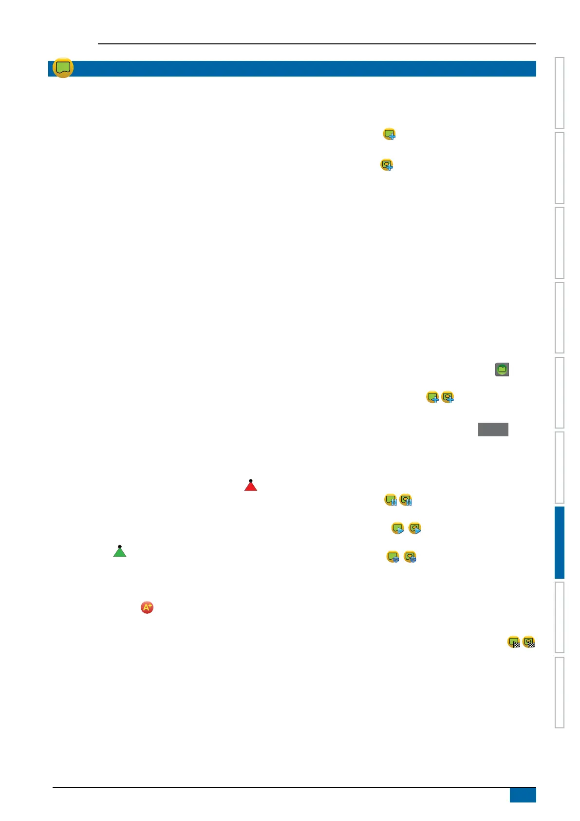
BOUNDARIES AND POLYGONS
Available on any guidance screen, the Boundaries and polygons
tab displays exterior boundary, interior boundary and polygon
options.
Mapping location
Mapping location establishes the layout of the location from which
the boundary or polygon will be mapped.
►Default location – While creating an exterior boundary or
polygon, the line will be to the exterior of the outermost
active section. While creating an interior boundary, the line
will be to the interior of the innermost active section. If no
sections are active, the boundary will be marked to the end
of the outermost section.
►User entry – in-line and lateral offset from the GNSS
antenna directions and distances can be specied by
the user. Up to ve (5) user entries can be created. See
“Conguration-> Mapping and guidance-> Mapping
location-> User entered mapping location” for details.
Application is not required to map a boundary or polygon.
If mapping a boundary or polygon with one or more sections
folded in and turned off, it is necessary to maintain this section
conguration for the duration of the boundary or polygon pass.
Any changes made to the number of sections turned on, and
therefore the width of the machine after the boundary or polygon
mapping process has started, will result in the application mapping
the boundary or polygon at the outer edge of all the programmed
sections – not necessarily those turned on at any given time
during the boundary or polygon pass.
When mapping a boundary or polygon with some sections turned
off, it is necessary to turn BoomPilot to Manual mode and
turn ON the master and section switches for all sections that will
be used during the boundary or polygon pass. Once the boundary
or polygon pass is complete the sections switches can be turned
OFF, master switch remains ON, BoomPilot can be returned to
Automatic mode and automatic section control can then be
used.
NOTE: If a boundary is mapped with some sections folded
as described above, it may be necessary to use the
A+ NUDGE icon on the guideline over to the correct
position for subsequent passes in the field.
Boundaries
Application boundaries establish the work areas where product is
or is not applied while using ASC or BoomPilot.
• Exterior boundary – establishes a work area where
application will be applied while using ASC or BoomPilot.
• Interior boundary – establishes a work area where
application will NOT be applied while using ASC or
BoomPilot.
Boundaries can be established in all guidance modes. Up to 100
total exterior boundaries and/or interior boundaries can be stored
within a single job. Application is not required to map a boundary.
Using Data-> Job data-> Manage or with Fieldware Link, a user
can duplicate and edit jobs for reuse of boundaries for different
applications over the same eld.
To establish an exterior or interior boundary:
1. Drive to a desired location at the perimeter of the
application area and orientate the vehicle in association
to the established mapping location. See “Configuration->
Mapping and guidance-> Mapping location” for details.
2. Press BOUNDARY AND POLYGON OPTIONS tab to
display boundary and polygon options.
3. Press MARK BOUNDARY icon .
4. Verify that the Mapping location is correct.
◄If the Mapping location is not correct, press Cancel then
go to Configuration-> Mapping and guidance-> Mapping
location.
5. Travel the perimeter of the application area.
While travelling, use as needed:
►Pause boundary – pauses the mark boundary
process.
►Resume boundary – resumes the mark boundary
process.
►Cancel boundary – cancels mark boundary
process.
6. Finish the boundary:
►Automatic close – travel to within one swath width of the
starting point. The boundary will close automatically (the
white guideline will turn black).
►Manual close – press the FINISH BOUNDARY icon
to close the boundary with a straight line between the
current location and the starting point.
NOTE: If the minimum distance is not travelled (five times
the swath width), an error message will pop-up.
7. Press:
►Save – to save the boundary
►Delete – to delete the boundary