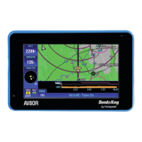
Honeywell Bendix/King AV8OR Handheld User’s Guide
VFR Moving Map Function D200803000008
Page 2-14 Rev 5 Mar 2012
© Honeywell International Inc. Do not copy without express permission of Honeywell
The following table lists the image overlays that can be displayed on
the primary maps:
• Flight Plan: When there is an active flight plan, the legs and
turning points of the flight plan are shown (Including Direct-To).
• Traffic: When a traffic device has a connection with AV8OR and
has been enabled, traffic icons are displayed on the map page, if
available.
• Flight Log Trail: Flight log points are plotted when the flight log
overlay has been enabled for the current map scale.
The following overlays require a current XM weather subscription
and a connection to a XM weather receiver to be displayed.
• Metar: If a meteorological aviation report (METAR) is available,
the METAR icon shows on the map.
• TFR: If a TFR is available, a yellow and black dashed TFR
boundary is displayed on the page.
• Lightning: If lightning strike data is available, lightning strike
icons are displayed on the page.
• Precip Type: If precipitation type data is available, the precip
type icon is displayed on the page.
• Nexrad Coverage: If Nexrad coverage is available, it is displayed
on the page.
• Cloud Top: If cloud top data is available, it is displayed on the
page.
• Storm Cell: If storm cell data is available, it is displayed on the
page.
The table below show which overlays are available for each primary
map: An “X” in the column indicates that the overlay is available for
the primary page at the top of the column
Table 2-1: Image Overlays on Primary Maps
Topo
On Map
Topo
Off Map
Nexrad
Map
Metar,
Pirep,
Winds
Aloft
Maps
Airmet
Sigmet
Maps
Flight X X X X X