Honeywell Bendix/King AV8OR Handheld User’s Guide
VFR Moving Map Function D200803000008
Page 2-30 Rev 5 Mar 2012
© Honeywell International Inc. Do not copy without express permission of Honeywell
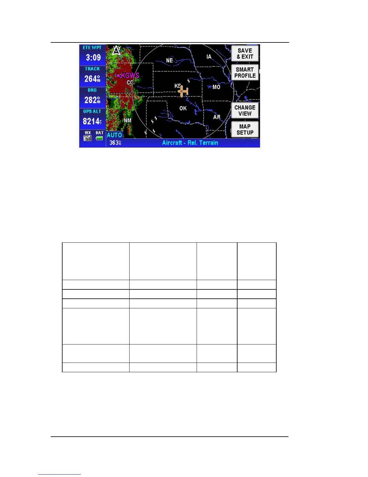
Figure 2-31: Map – Relative Terrain
o On the Relative Terrain map, the terrain is colored
according to its height relative to the aircraft, as shown
in the following table.
o A 0.5 nm radius circle around each is colored according
to the height of the obstacle relative to the aircraft, as
shown in the following table.
Table 2-5 Relative Terrain
Relative Terrain
Altitude (feet)
Relative
Obstacle
Altitude (feet)
Color Dither
Pattern
Percent
Filled
>= +250 >= -250 Red 50%
-250 to +249 -750 to
251 Yellow 50%
-750 to –251 -1250 to
751 Yellow 25%
-1250 to –751 -17500 to
1251 Dark
Green
/Dark
Yellow
50%
-2000 to –1251 < -2000 to -1751 Dark
Green
100%
< -2000 < -2000 Blac
100%
o At ranges of 200 nm and less, areas not covered by
the terrain database are displayed using a 50 % red
dithered pattern.
o The Relative Terrain Map is rotated and scaled
consistent with the current map location, orientation
and range.