FlexLine plus, Programs
85
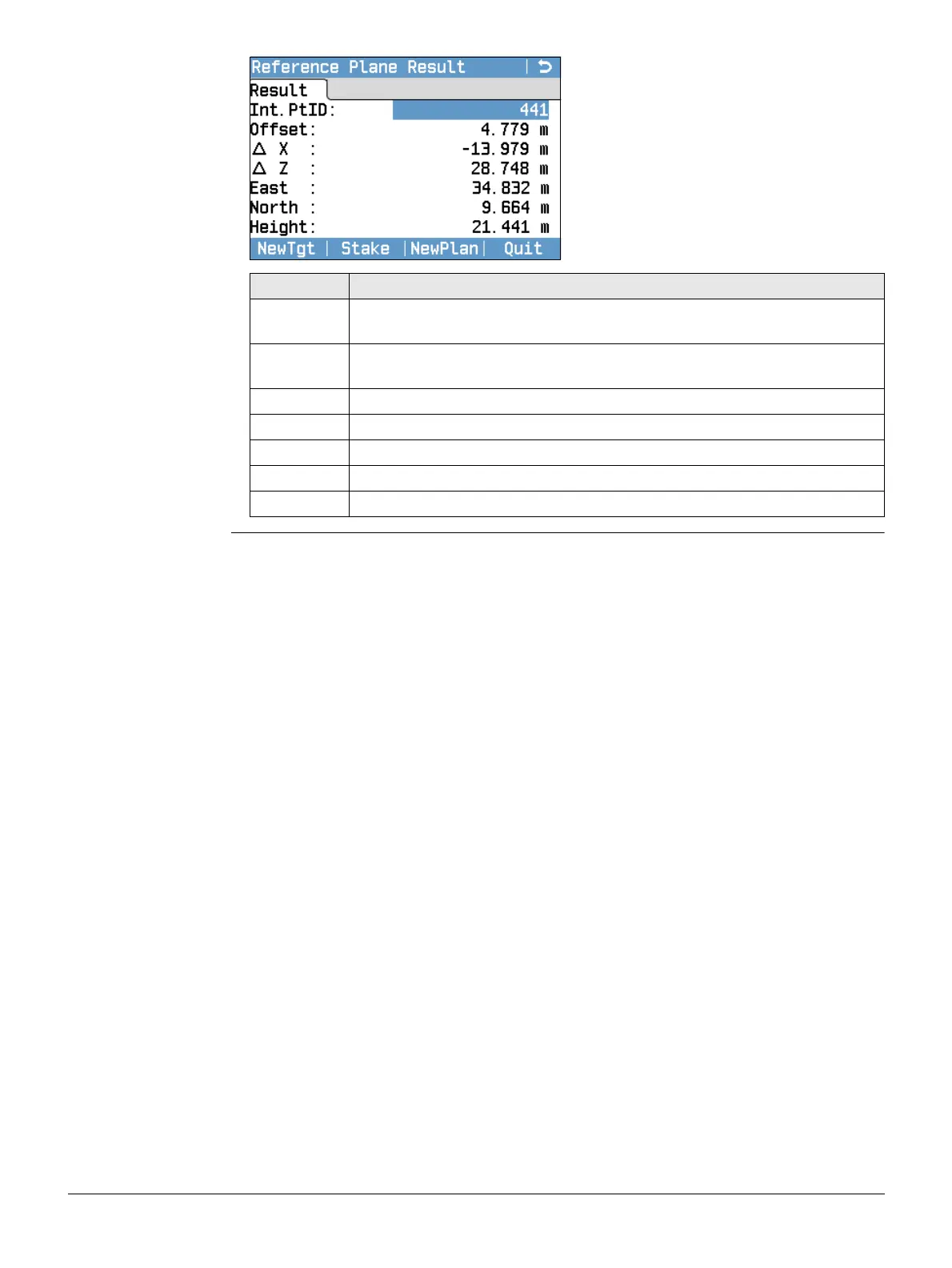
Reference Plane
Result
NewTgt
To record and save the intersection
point and to proceed to measure a
new target point.
Stake
To display stake out values and a
graphic for the intersection point.
Refer to "3.7 Graphic Symbols" for an
explanation of the graphic symbols.
NewPlan
To define a new reference plane.
Field Description
Int.PtID Point ID of the intersection point, the perpendicular projection of the
target point on the plane.
Offset Calculated perpendicular distance between target point and plane
(intersection point).
∆ X Perpendicular distance from the intersection point to the local Z-axis.
∆ Z Perpendicular distance from the intersection point to the local X-axis.
East Easting coordinate of the intersection point.
North Northing coordinate of the intersection point.
Height Height of the intersection point.