EasyManuals Logo

STONEX R2 PLUS User Manual

STONEX R2 PLUS
144 pages
To Next Page IconTo Next Page
To Previous Page IconTo Previous Page
Page #79 background imageLoading...
Page #79 background image
Stonex R2 PLUS Total Station - User Manual 77
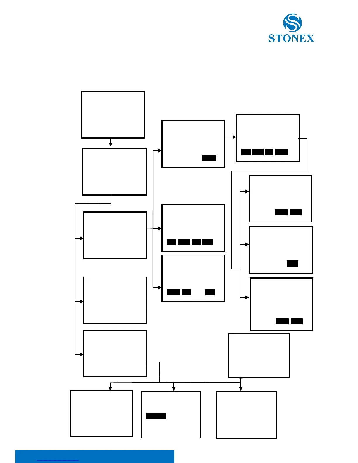
20. Road Staking Out Measurement
This program is especially designed for Road Layout measurement. It can be used for horizontal
curve layout. Normally one road is constituted by several elements, such as line, circle curve or
Spline.
Menu P3
1.Road Calculation
Road Calculation
1.Input the parameter
2.Road Setout
3.Road file
Road Define
1.Horizontal Curve
2.Vertical curve
3.Road Calculation
Road Setiyt
1.Occ.Orientation
2.Road Setout
3.Road data view
Road File Select
1.Road File Select
2.Road File Rename
3.Road File Delete
4.Road Initialize
HCurve/Start Point
STATION: 0.000
Np : 0.000
Ep : 0.000
Zp : 0.000
0OK0
StartPine Height
TOP LAST DEL ADD
RoadCal/Calc
STATION: 0.000
SPAC 10.000
WIDE PEG ENT
Type EndPile
DEL LINE CIR CURV
Road File Select
ROAD1 0
ROAD2 0
ROAD3 0
ROAD4 0
ROAD5 0
Road File
Rename
ROAD1
Road File Select
ROAD1 0
ROAD2 0
ROAD3 0
ROAD4 0
ROAD5 0
Clear all roads?
Select 1
1
2
3
1
F2
3
1
2
3
4
Input Start station
H road elements list
Line Input/LENGTH
Dist 0.000m
Azimuth 0°0000
ENDP ENT
Circle Input
Dist 0.000m
Rad 0.000m
Azimuth 0°0000
Turn LEFT
ENT
Spiral Input
Dist 0.000m
Rad 0.000m
Azimuth 0°0000
Turn LEFT
Direction IN
ENDP ENT
F3
F4
2

Table of Contents

Questions and Answers:

Question and Answer IconNeed help?

Do you have a question about the STONEX R2 PLUS and is the answer not in the manual?

STONEX R2 PLUS Specifications

General IconGeneral
BrandSTONEX
ModelR2 PLUS
CategoryMeasuring Instruments
LanguageEnglish

Related product manuals