CHAPTER 5 REFERENCE GUIDE
EFD1000/500 MFD Pilot’s Guide
Page 5-58 091-00006-001 REV B
EFD1000/500 MFD Pilot’s Guide
Page 5-59091-00006-001 REV B
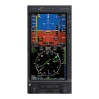
When a GPS source’s position data are invalid or no longer available, an amber
annunciation, GPS1, GPS2, or RSM GPS, is shown to the left of the lower display to
indicate which has failed (Figure 5-70). If Basemap features are invalid or unavailable all
features except the ight plan are removed from the display.
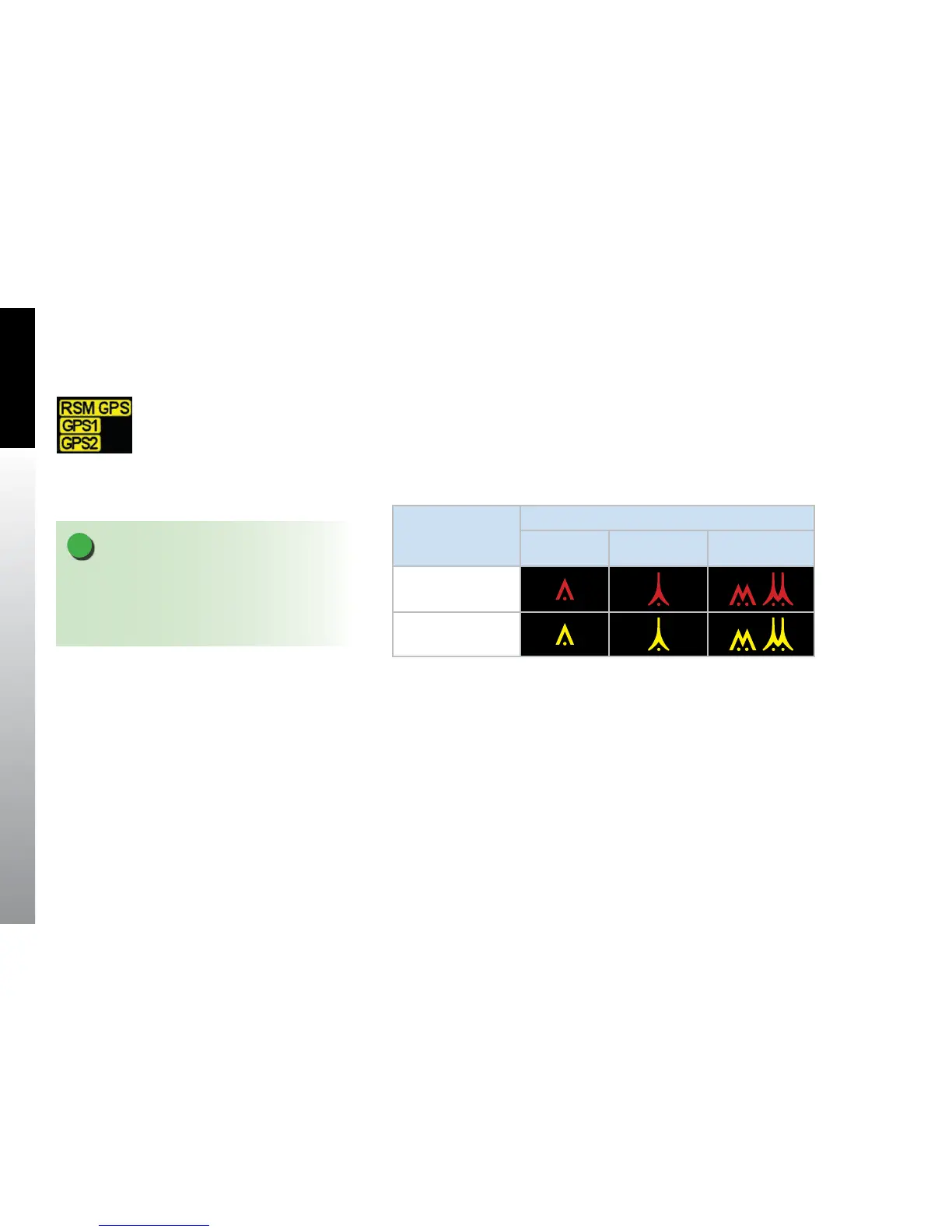
Obstructions are displayed on Terrain VIEW within 40 nm of the ownship, as an inverted
colored V symbol relative to ownship altitude (Table 5-19). When enabled for display,
obstructions are rendered as follows:
Relative Altitude
Obstruction Type
Small Tower
(<1000’ AGL)
Tall Tower
(>1000’ AGL)
Group
Obstructions
At and above
Within 500’ below
Table 5-19 Obstruction Symbology
NOTE
A safety threshold of 200 feet is applied to the terrain
and obstruction thresholds for all phases of ight,
making the terrain and obstructions appear closer
than computed.
Figure 5-70
Invalid or Failed GPS Annunciations