EFD1000/500 MFD Pilot’s Guide
Page xxxii 091-00006-001 REV B
EFD1000/500 MFD Pilot’s Guide
Page PB091-00006-001 REV B
Example Graphics
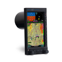
The example graphics and screen shots used throughout this Pilot’s Guide are provided
for reference only and are taken from a simulated ight. They should not be used for
actual ights.
Most of the example graphics and screen shots used throughout this Pilot’s Guide
& Reference are based on ying the ILS 16R instrument approach into Reno/Tahoe
International Airport (KRNO) in Reno, Nevada, USA. Those images with the airplane in
a right bank show the airplane completing the procedure turn in-bound to intercept
the Localizer, descending through 8,660 feet to the target altitude of 8,500 feet. The
other main group of images, showing the airplane straight and level, are earlier in the
approach, tracking outbound for the procedure turn.
Pilot Familiarity
While the EFD1000 is reasonably intuitive and easy to use, some familiarity with
Electronic Flight Instrument Systems (EFIS) and Horizontal Situation Indicators (HSI)
is required. Aspen Avionics strongly recommends that new users of the EFD1000 get
some dual instruction from an experienced instrument CFI, and spend some time
becoming familiar with the PFD in day VFR conditions with a safety pilot, before ying in
actual instrument meteorological conditions (IMC). To reduce pilot workload, the use of
autopilot (when available) is strongly encouraged.
Map Orientation
All references are magnetic except the orientation of the North Up navigation map.
Track display on the navigation map shows the actual aircraft direction, displaying the
magnetic track plus the magnetic variation.