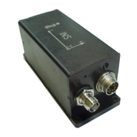
INS
GUI User’s Manual
Inertial Labs, Inc
TM
Address: 39959 Catoctin Ridge Street, Paeonian Springs, VA 20129 U.S.A.
Tel: +1 (703) 880-4222, Fax: +1 (703) 935-8377 Website: www.inertiallabs.com
201
Table C.13 (continued)
Table C.13 (continued)
Notes
1. USW is unit status word (see Appendix D for details).
2. The following data are recorded in the field “Vdd” sequentially:
- the INS input voltage, Vinp, VDC*100;
- stabilized voltage supplied to the INS sensors, Vdd, VDC*1000;
3. In the “Utermo” field ADC codes are recorded sequentially from 7 temperature
sensors inside gyros, accelerometers and magnetometers.
4. ms_gps are milliseconds from the beginning of the GPS reference week;
5. TS_gps is time status which indicates the quality of the GPS reference time (see
Table C.4);
6. sol_stat is GNSS solution status (see Table C.14);
7. pos_type is GNSS position type (see Table C.15);
8. #SVs is number of satellites tracked;
9. #SolnSVs is number of satellites used in navigation solution;
10. #SolnL1SVs is number of satellites with L1/E1/B1 signals used in solution;
11. #SolnMultiSVs is number of satellites with multi-frequency signals used in solution;
12. ext_sol_stat is GNSS extended solution status (see Table C.16);
13. GPS and GLONASS is GPS and GLONASS signal-used mask (see Table C.17);
14. Galileo and BeiDou is Galileo and BeiDou signal-used mask (see Table C.18);
15. V_latency is latency in the velocity time tag in milliseconds;
16. UP and UT are raw data from the pressure sensor – pressure and temperature.
17. New_GPS is indicator of new update of GPS data (see Table C.6);
18. The low byte is transmitted by first.
 Loading...