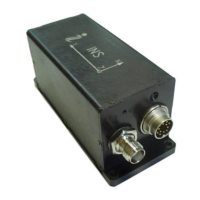
INS
GUI User’s Manual
Inertial Labs, Inc
TM
Address: 39959 Catoctin Ridge Street, Paeonian Springs, VA 20129 U.S.A.
Tel: +1 (703) 880-4222, Fax: +1 (703) 935-8377 Website: www.inertiallabs.com
199
1. Angular rates, linear accelerations and magnetic fields are in the carrier object axes (X
is lateral axis, Y is longitudinal axis, Z is vertical axis).
2. g = 9.8106 m/s
2
.
3. USW is unit status word.
4. Vinp is input voltage of the INS.
5. Temper is averaged temperature in 3 gyros.
6. ms_gps are milliseconds from the beginning of the GPS reference week;
7. GNSS_info1, GNSS_info2 contain information about GNSS data;
8. #SolnSVs is number of satellites used in navigation solution;
9. Latency ms_head, Latency ms_pos, and Latency ms_vel are latencies of heading,
position and velocity GNSS data in milliseconds;
10. Angles position type is GNSS position type at orientation calculation using dual
GNSS antennas. If this value is less than 100 then see its description in the Table C.15.
Otherwise subtract 100 from the “Angles position type” and refer again to the Table C.15;
11. P_bar, H_bar – pressure and barometric height;
12. New_GPS is an indicator of new update of GPS data (see Table C.6);
13. New aiding data is an indicator of update of external sensors data (see Table C.12);
14. The low byte is transmitted by first.
Table C.12 New aiding data indicator
0 – data absent
1 – data updated
0 – data absent
1 – data updated
0 – data absent
1 – data updated
North wind component
East wind component
North wind STD
East wind STD
0 – data absent
1 – data updated
Latitude external
Longitude external
Altitude external
Latitude external STD
Longitude external STD
Altitude external STD
External position latency
Doppler shift from locator
0 – data absent
1 – data updated
Locator latitude
Locator longitude
Locator altitude
Doppler shift
Doppler shift STD
 Loading...