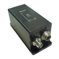
INS
GUI User’s Manual
Inertial Labs, Inc
TM
Address: 39959 Catoctin Ridge Street, Paeonian Springs, VA 20129 U.S.A.
Tel: +1 (703) 880-4222, Fax: +1 (703) 935-8377 Website: www.inertiallabs.com
210
Table C.25 (continued)
Table C.25 (continued)
Notes:
1. TOW (time of week) are seconds from the beginning of the GPS reference week.
2. Angular rates, linear accelerations and magnetic fields are in the carrier object axes (X
is lateral axis, Y is longitudinal axis, Z is vertical axis). The INS orientation relative to the
carrier object axes is set by alignment angles (see Appendix E. Variants of the Inertial
Labs
TM
INS mounting relative to the object axes).
3. P_bar is pressure;
4. Temper is averaged temperature in 3 gyros.
5. USW is unit status word (see Appendix D for details).
6. pos_type is GNSS position type (see Table C.15);
7. GNSS_PACC is 3D position accuracy estimate (1 sigma).
8. GNSS_SACC is speed accuracy estimate (1 sigma).
9. #solnSVs is number of satellites used in navigation solution.
10. GNSS_info1, GNSS_info2 contain information about GNSS data (see Table C.4,
Table C.5).
11. Diff_age is age of differential correction.
12. UTC is the absolute number of seconds since midnight, January 1, 1970, including
leap seconds. A value of zero indicates that UTC is not available.
13. "GPS Decimal Seconds" are milliseconds part of the UTC time.
14. Latency ECEF_time, Latency pos_time, Latency vel_time – are latencies of time
stamps in received BESTXYZ, BESTPOS, BESTVEL logs relative to INS time
synchronized to the receiver PPS.
15. V_latency – is the latency in the velocity time tag.
16. New_GPS is indicator of new update of GPS data (see Table C.6).
17. The low byte is transmitted by first.
 Loading...