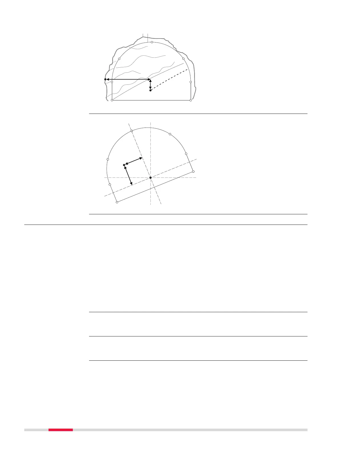
a Centreline
b
P
oint to stake out on excava-
ted profile
c Excavated profile
d Design profile
e Centreline offset
f Centreline height difference
a Centreline
b R
otated centreline offset
c Rotated centre height differ-
ence
47.3.4 Scan profile
A tunnel surface is scanned in detail during construction and/or at the comple-
tion o
f construction to detect overbreak, underbreak and/or to create an 'as
built plan' of the finished tunnel surface.
Scan profile allows measur
ing a user-defined number of tunnel profiles along
an existing tunnel alignment.
It can be defined:
•
Whether t
o scan the whole tunnel profile or just a segment of it.
•
The interval between measurements around the profile.
It does not matter if a design profile exists in the job or not.
If the job does not contain a design profile, then before scanning the defined
scan ar
ea the instrument will first scan a profile at the instrument chainage.
For a description of the Scan Profile, Scan area page, refer to "47.3.1 Over-
view".
Rotated profile
Overview
☞
☞
830 Roads - Tunnel
 Loading...