Do you have a question about the Koden MDP-621 and is the answer not in the manual?
Explains safety symbols used within the operation manual for clear understanding before use.
Details safety symbols found on the equipment itself for operation precautions.
Provides general guidelines and factors to consider before installing the unit.
Instructions for installing the display unit via table or flush mounting methods.
Guidance on selecting the optimal location and mounting the scanner unit.
Details on connecting the various scanner units and system components.
Information on recommended power supply connections and cable sizing.
Steps for performing necessary adjustments and setup after the physical installation.
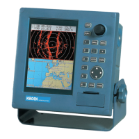
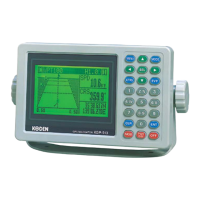
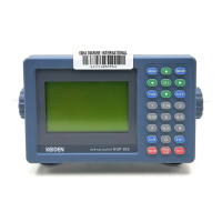
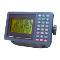
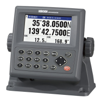
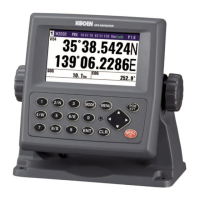
Description of the unit's operating panel, including keys and controls.
Instructions on turning the unit's power supply on and off.
Guide to using the soft keys for various operational functions and menu navigation.
How to select and change between different display screen combinations and configurations.
Steps for setting display colors and adjusting screen brightness and panel illumination.
Procedure for using the POB key for emergency position storing and rescue functions.
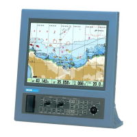
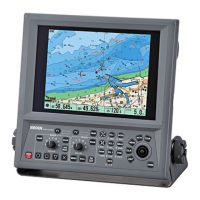
Explanation of the plotter screen layout and its various display elements.
Instructions on how to zoom in and out to change the plotter screen scale.
Detailed guide on operating plotter functions using the soft key menus.
Procedure for registering marks at specific positions for navigation reference.
Methods for selecting and erasing marks based on cursor position or color/shape.
How to display and erase the ship's recorded track data.
Instructions on switching between different screen display modes like North Up, Head Up.
Guide to setting up and managing waypoint and route navigation.
Procedure for setting destination and route points using the cross cursor.
How to select waypoints from previously registered mark data.
Steps for recalling and navigating using registered route data.
Explanation of the radar screen layout and its various display elements.
Initial steps and warm-up procedures for operating the radar system.
How to adjust the radar's detection range for optimal viewing.
Detailed guide on operating radar functions using the soft key menus.
Methods for adjusting radar gain, STC, and FTC for optimal image quality.
Using EBL and VRM tools to measure target bearing and distance.
Techniques to reduce or eliminate interference from other radar sources.
Configuration of the guard zone alarm for target detection.
Configuration and operation of the Automatic Tracking Aid function.
Procedure for adjusting the radar's tuning circuit for optimal performance.
Explanation of the sounder screen layout and its various display elements.
How to set and select the desired depth range for the sounder.
Detailed guide on operating sounder functions using the soft key menus.
Configuration of automatic sounding range and shift modes.
Methods for adjusting image sensitivity and enhance for better detection.
Procedure for adjusting STC for amplitude and depth to improve echo clarity.
How to use the IR function to eliminate interference from other sounders.
Configuration of sea bottom and fish school alarms for detection alerts.
Overview of the navigation data displayed on the screen.
Guide to operating navigation data display and alarm settings.
How to cycle through different navigation data displays like position and waypoint info.
Configuration of various navigation alarms such as arrival, speed, and course deviation.
How to access and navigate through the various menu screens.
Settings for system-wide functions including buzzer, display, and network.
Configuration options for the plotter display, setup, and data management.
Configuration options for radar display, image, ATA, and adjustments.
Configuration options for sounder display, image, transmission, and adjustments.
Configuration settings for navigation data, GPS, Loran C, Decca, and NMEA.
Details needed when requesting technical assistance or service.
How the system performs self-diagnostics upon startup.
A guide to diagnosing and resolving common faults and issues.
Routine maintenance procedures to prolong equipment life and performance.
Scheduled monthly inspection and cleaning tasks for the equipment.
Scheduled yearly inspection of the transducer for marine growth.
| Receiver Type | GPS |
|---|---|
| Display Resolution | 320 x 240 pixels |
| Operating Temperature | -15°C to +55°C |
| Type | Marine GPS Plotter |
| Channels | 12 |
| Accuracy | 15 meters |
| Display | Color LCD |