Safe Taxi (If Equipped)
SafeTaxi is an enhanced feature that gives greater map detail when viewing
airports at close range. The maximum map ranges for enhanced detail are
pilot congurable. When viewing at ranges close enough to show the airport
detail, the map reveals taxiways with identifying letters/numbers, airport Hot
Spots, and airport landmarks including ramps, buildings, control towers, and
other prominent features. Resolution is greater at lower map ranges. When
the MFD display is within the SafeTaxi ranges, the airplane symbol on the
airport provides enhanced position awareness.
Designated Hot Spots are recognized at airports with many intersecting
taxiways and runways, and/or complex ramp areas. Airport Hot Spots are
outlined to caution pilots of areas on an airport surface where positional
awareness confusion or runway incursions happen most often. Hot Spots
are dened with a magenta circle or outline around the region of possible
confusion.
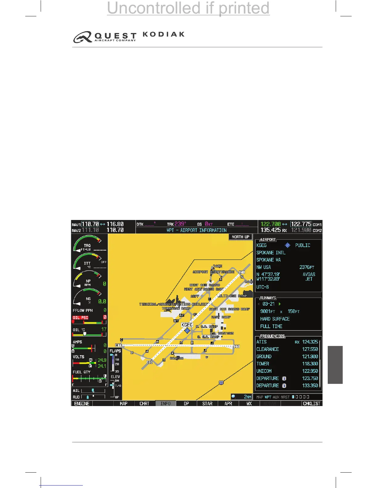
During ground operations the aircraft’s position is displayed in reference to
taxiways, runways, and airport features. In the example shown, the aircraft
is on taxiway Bravo inside the High Alert Intersection boundary on KGEG
airport. Airport Hot Spots are outlined in magenta. When panning over the
airport, features such as runway holding lines and taxiways are shown at the
cursor.
Figure 7-40 – SafeTaxi Depiction on the Navigation Map Page
 Loading...