9. Raster Chart Material
9-6
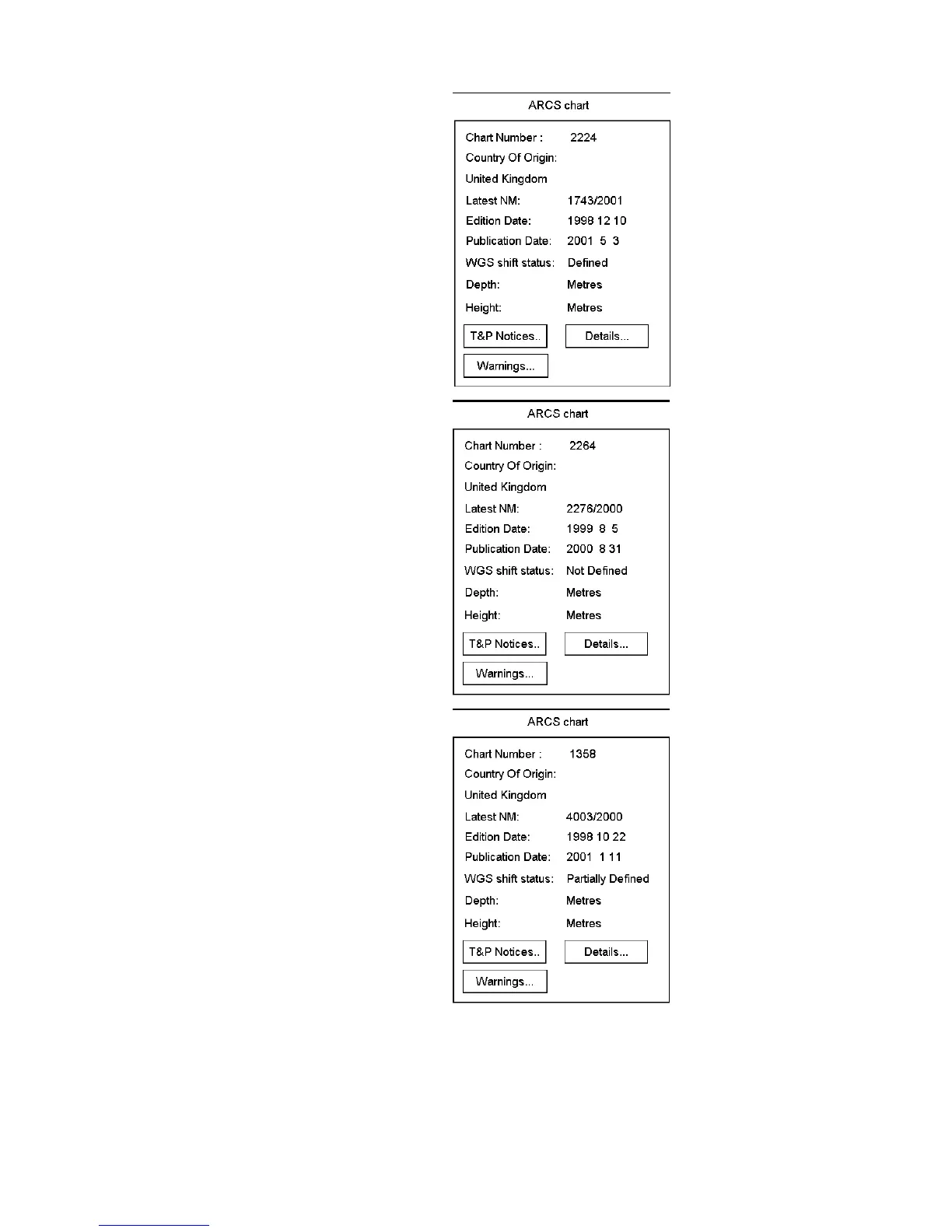
WGS shift is defined for this chart. All latitude and
longitude positions of the cursor, routes, user charts,
pilot data, etc. are correctly displayed on this ARCS
chart.
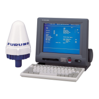
WGS shift is not defined for this chart. Latitude and
longitude positions of the cursor, routes, user charts,
pilot data, etc. may not be correctly displayed on the
current ARCS chart. You can use WGS shift to
define correct transformation from WGS-84 co-
ordinates to local datum of the current ARCS chart.
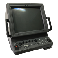
WGS shift is partially defined for this chart. Some
parts or panels of this chart do not have defined
WGS shift. Latitude and longitude positions of the
cursor, routes, user charts, pilot data, etc. may not be
correctly displayed on current ARCS chart. You can
use WGS shift to define correct transformation from
WGS-84 co-ordinates to local datum of the ARCS
chart for the parts or panels of this chart that do not
have defined WGS shift.