3. ECDIS Display
3-5
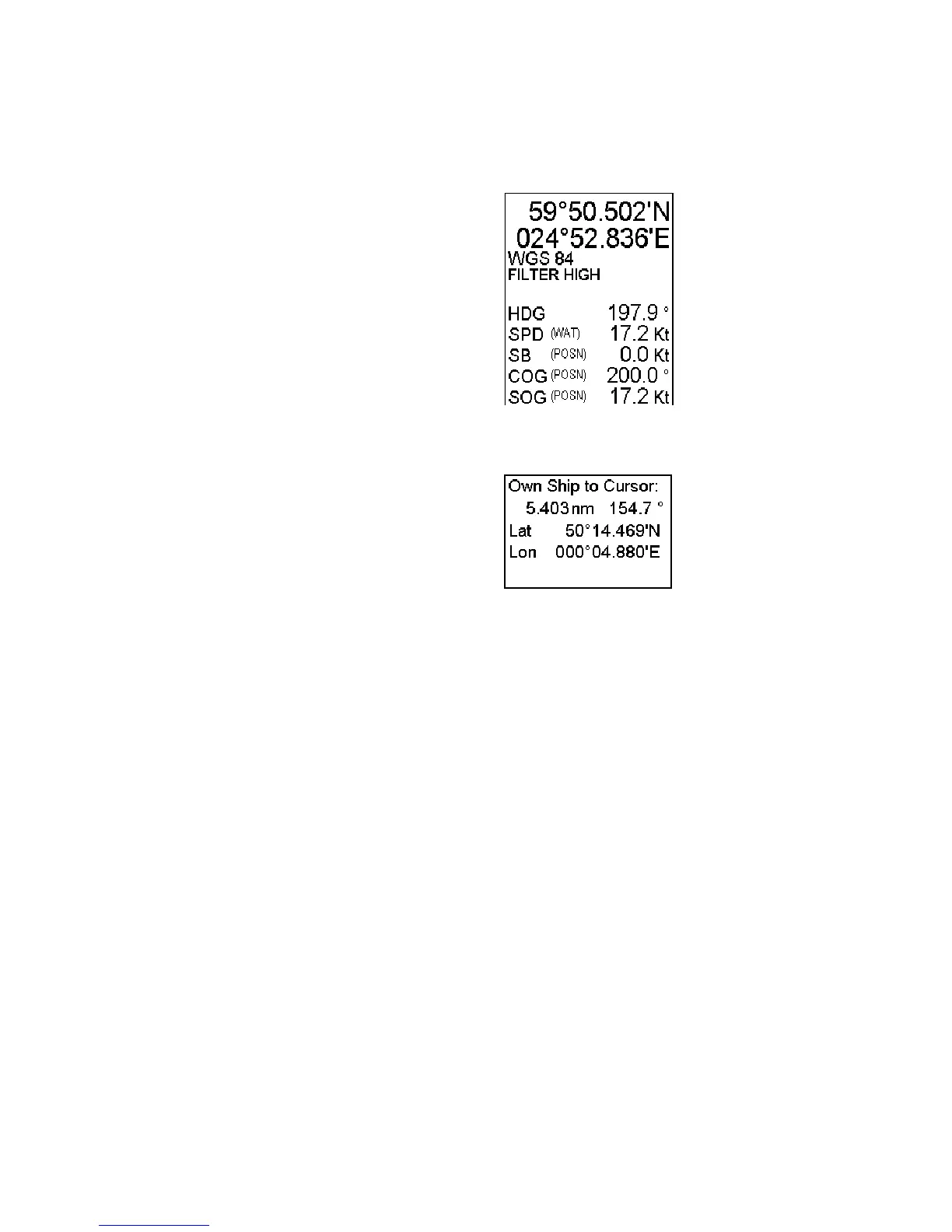
Information area
The information area displays details about your ship's position, course and speed and the cursor's location on the
chart
Information from the positioning sensors:
• Latitude and longitude position of your ship
• Datum in use (WGS 72, WGS 84, European 1950,
etc.), which is shown above positioning source.
• Positioning source: Dead Reckoning, GPS, DGPS,
LORAN, FILTER, etc.
• HDG reading and its source if it is not true gyro.
• SPD water speed
• SB, Transversal speed, positive value to Starboard
• COG (Course over ground) and its source)
• SOG (Speed over ground)
• Range and bearing from your ship's position to cursor
• Latitude and longitude position of cursor displayed in
chosen datum.
Note: The order of items in the position and cursor
windows can change with the sidebar used. See the next
page.