MULTI PHASE
NAVIGATION management & monitoring 5
WAYPOINT [1L]
Enables display of WPT definition
data as contained in NAVdb or in
pilot data memory (either defined
and stored via NEW WPT page, or
by F-PLN revision e.g. Lat/Long,
PBD, PBX and PD).
Defined F-PLN WPTs created by F-
PLN revisions, but not stored into
the stored WPT list, such as abeam,
radial intercept points may be
reviewed as long as they are being
used in a flight plan.
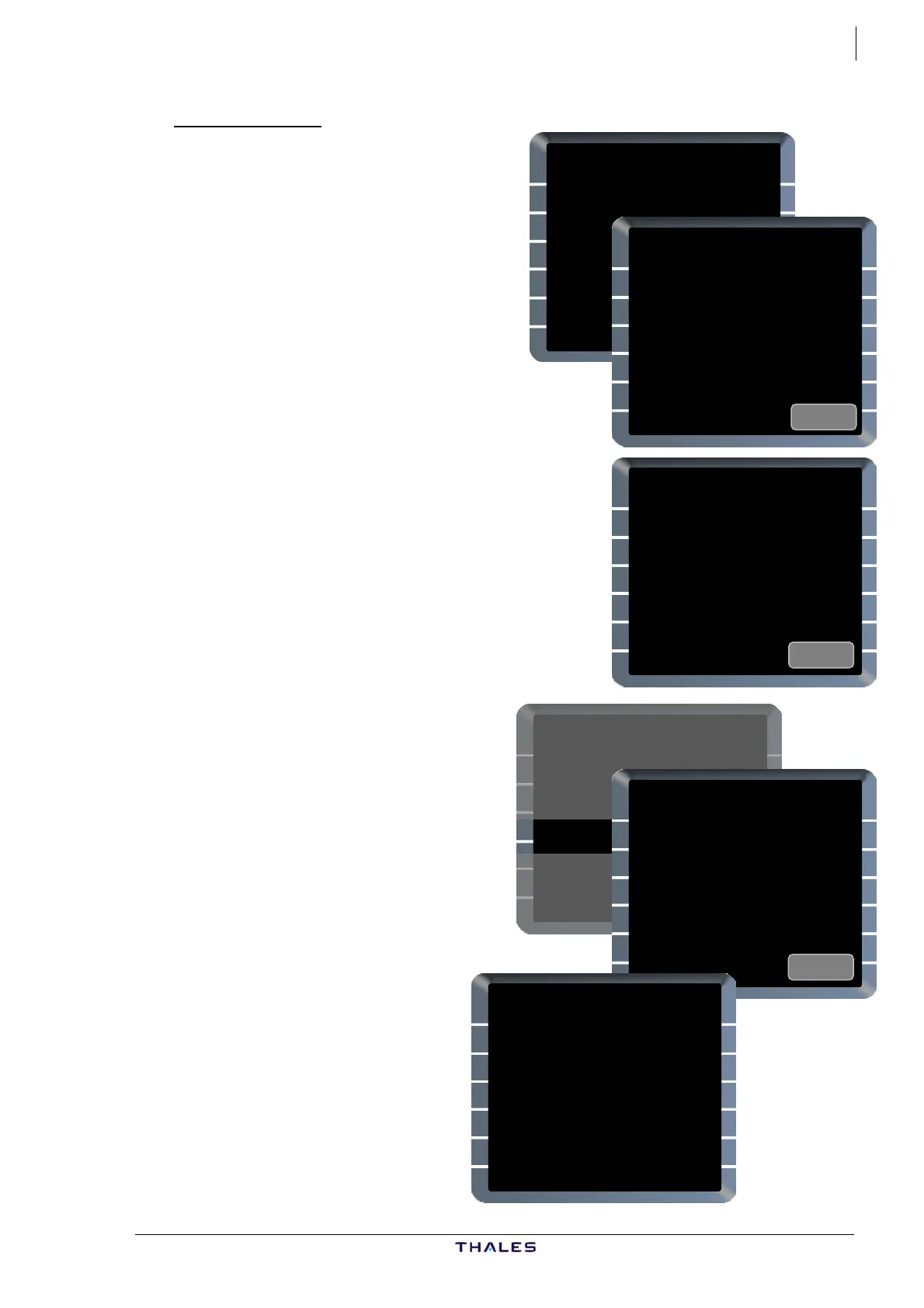
From DATA page 2/2:
WAYPOINT [1L] ......Press
Waypoint page is displayed with
amber boxes in [1L].
IDENT[1L]............... Enter
Enter WPT ident. LAT/LONG are
displayed.
Ex 1: ADABI.
If the WPT has been defined as a
PBD, PBX or PD associated data are
shown.
Ex 2: TOU1 is a created WPT
as TOU/350°/50NM which h
been stored.
WAYPOINT
IDENT
_______
ADABI
WAYPOINT
IDENT
ADABI
LAT/LONG
4633.7N/00031.9E
Ex. 1
WAYPOINT
IDENT
TOU1
LAT/LONG
4350.6N/00115.6E
PLACE /BRG /DIST
TOU /350° /10.0
E
. 2
THV001 {}
C144° TIME SPD/ALT
D144H} 1502 / *3130
C356° 8
TOU 1505 250/ FL85
7° 3 (SPD) TRK35
(LIM) 1505 FL100*250/
17
PD01 1509 .79/ FL360
FIST5A 27NM
FISTO 1514 " / "
DEST UTC DIST EFOB
EGLL27R 162 532 4.35
£$
WAYPOINT
IDENT
PD01
LAT/LONG
4400.8N/00116.5E
PLACE /DIST
TOU /20.0
Ex. 3
NEW WAYPOINT
IDENT
XYZ
LAT/LONG
____.__/_____.__
PLACE /BRG /DIST
_______/___° /___._
PLACE-BRG /PLACE-BRG
_____-___° /_____-___°
RETURN>
as
Ex 3: PD01 is a created WPT
by F-PLN revision downpath
TOU at 50NM.
If the IDENT is not r
by the system, the NEW
WAYPOINT page is displayed.
See Pilot da
ecognized
ta.
AIRBUS A318/319/320/321
© THALES AVIONICS S.A.
J43126AA 00