A
MCDU NAMING and DATA FORMAT
PPENDICES
7
AIRBUS A318/319/320/321
© THALES AVIONICS S.A.
J43126AA 00
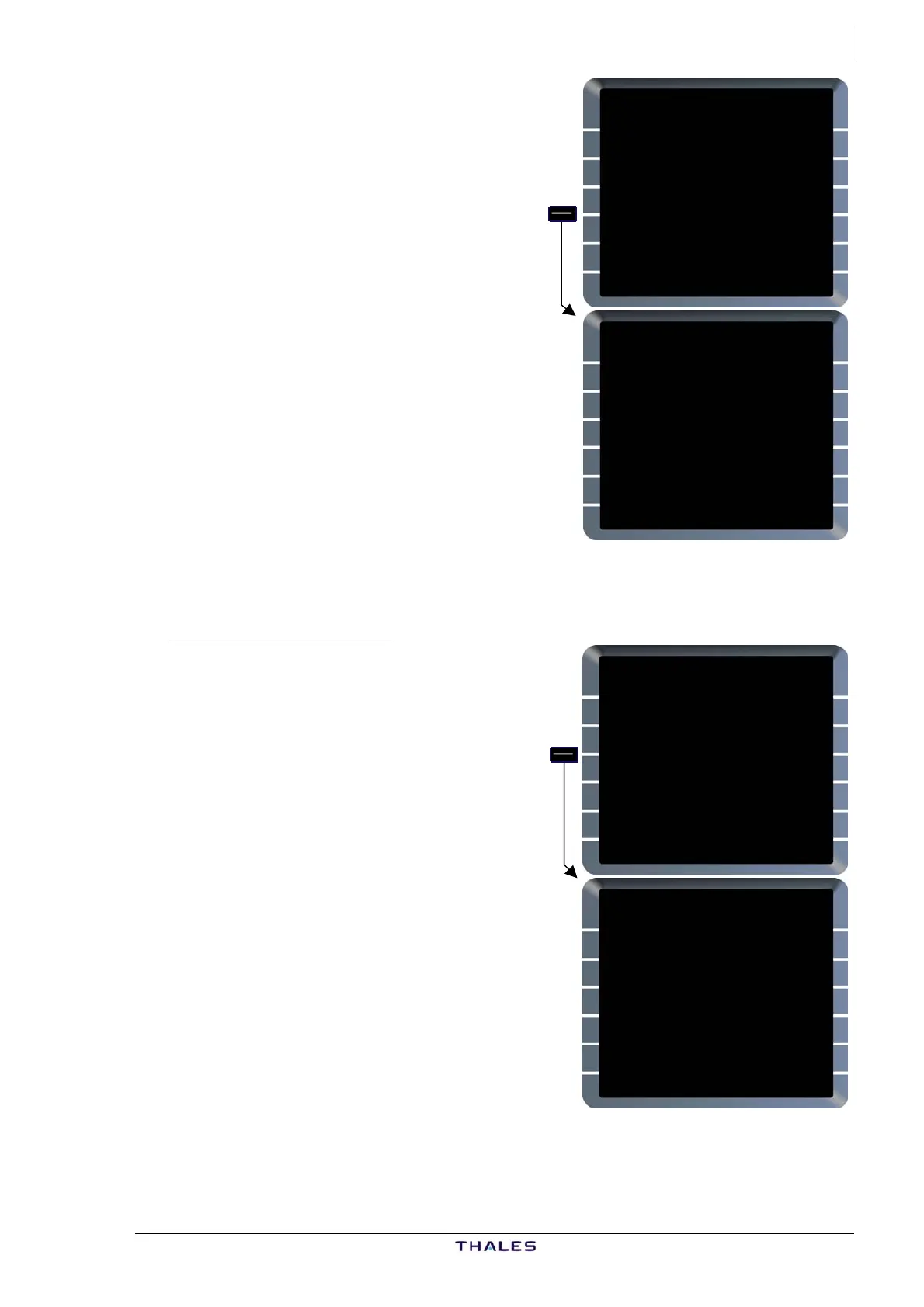
LAT REV FROM N46E001
46°00.0N/001°00.0E
NEXT WPT
<HOLD [ ]
ENABLE NEW DEST
{ALTN [ ]
TMPY
<F-PLN
FROM TMPY THV001 {}
UTC SPD/ALT
T-P 0629 / FL360
BRG329° 27
FOUCO 0734 .79/ FL360
TRK059° 26
N46E001 0739 " / "
21
N46E001 0741 " / "
---F-PLN DISCONTINUITY--
TMPY TMPY
{ERASE INSERT*
$£
This example shows two LL WPTs.
The first one is:
46°00.0N/001°00.0E
The second one is:
46°00.0N/001°30.0E
PLACE/BRG/DIST (PBD)
If the flight crew defines a waypoint
as a PLACE/BRG/DIST the FM
abbreviates this to PBDNN where NN
is a two digit number indicating the
number of the PLACE/BRG/DIST
definition.
PBDNN becomes the identifier of the
waypoint and may be used as for any
other waypoint identifier. A waypoint
defined this way becomes one of the
20 pilot defined waypoints.
NN is the first number between 01
and 20, which is not already used for
another pilot defined waypoint
abbreviation in that list.
FROM THV001 {}
UTC SPD/ALT
T-P 0446 / FL159
BRG344° 27
FOUCO 0919 .79/ FL360
UN874 TRK005° 48
ADABI 0926 " / "
UN874 30
BOKNO 0930 " / "
UN874 27NM
DEVRO 0934 " / "
DEST UTC DIST EFOB
EGLL27R 1021 416 3.8
CGC/50/40 £$
FROM TMPY THV001 {}
UTC SPD/ALT
T-P 0446 / FL159
BRG344° 115
FOUCO 0920 .79/ FL360
TRK353° 22
PBD02 0923 " / "
---F-PLN DISCONTINUITY--
ADABI 0927 .79/ "
TMPY TMPY
{ERASE INSERT*
$£