APPENDICES
MCDU NAMING and DATA FORMAT 5
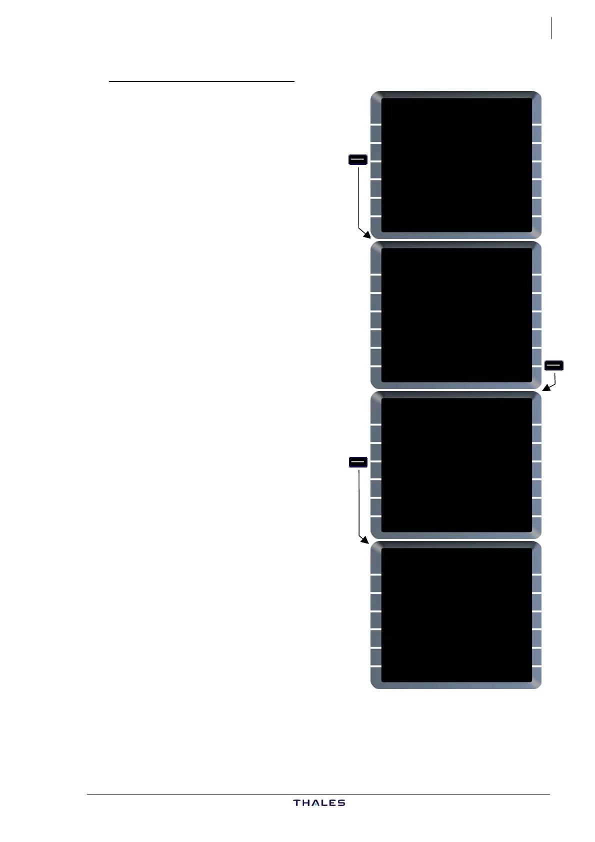
LAT/LONG (LLXX or NXXEXXX)
LAT REV FROM LL01
46°00.0N/001°00.0E
NEXT WPT
<HOLD [ ]
ENABLE NEW DEST
{ALTN [ ]
TMPY
<F-PLN
FROM TMPY THV001 {}
UTC SPD/ALT
T-P 0629 / FL360
BRG329° 27
FOUCO 0734 .79/ FL360
TRK059° 26
LL01 0739 " / "
---F-PLN DISCONTINUITY--
ADABI 0744 .79/ "
TMPY TMPY
{ERASE INSERT*
$£
NEW WAYPOINT
IDENT
LL01
LAT.LONG
4600.0N/0100.0E
RETURN>
STORE}
FROM THV001 {}
UTC SPD/ALT
T-P 0629 / FL360
BRG329° 27
FOUCO 0734 .79/ FL360
UN874 TRK005° 48
ADABI 0741 " / FL360
UN874 30
BOKNO 0745 " / FL360
UN874 27NM
DEVRO 0748 " / FL360
DEST UTC DIST EFOB
EGLL27R 0836 416 3.8
4600N/100E $£
If the OPC option ”WAYPOINT
ABBREVIATION” is LLXX:
When pilot defines a waypoint by
LAT/LONG, the FM abbreviates it to
LLXX where XX is a two digit number
indicating the number of the
LAT/LONG definition.
LLXX becomes the waypoint i
and may be used as any other
waypoint identifier.
de
ecomes
ntifier
A waypoint defined this way b
one of the 20 pilot defined
waypoints.
XX is the first number between 01
and 20, which is not already used for
another pilot defined waypoint
abbreviation in that list.
AIRBUS A318/319/320/321
© THALES AVIONICS S.A.
J43126AA 00