100
Latitude, Longitude—Displays current
position (in longitude and latitude).
Elevation—Shows elevation of receiver.
Heading—Displays degree heading of travel.
Number of Satellites—Number of tracked
satellites used in position fix.
Differential
• No Diff—Indicates the receiver is not
receiving a differential GPS signal.
• Diff On—Indicates the receiver is
receiving a differential GPS signal.
• GLIDE—GPS 6000/GPS 6500 Only.
• WAAS/EGNOS
• Ter raSta r—GPS 6500 Only.
• RTK Fixed—The receiver is receiving a
valid RTK differential source.
• RTK Float—The receiver is receiving information from the Base Station, but the signal is not strong enough for an
RTK fix.
GPS Speed—Real-time speed of travel.
Position Rate—The frequency that the receiver is sending the display the position in longitude and latitude (GGA). For
example, at 10 Hz the display would be receiving a position message 10 times every second.
Speed/Heading Rate—The frequency that the receiver is sending the display ground speed and heading (VTG)
÷
NOTE!: Position Rate and Speed/Heading Rate should both be set at a minimum of 5 Hz for guidance or steering.
Change Longitude/Latitude Format—Pressing this button changes the Longitude/Latitude format. These
can either be shown in Degrees, Minutes and Seconds; or Decimal Degrees.
View Messages button—see “GPS Messages” on page 101.
UTC Time—UTC is an acronym for Coordinated Universal Time, a high-precision atomic time standard that defines local
time throughout the world. If receiving information from satellites, the UTC Time should automatically update.
UTC Date—If receiving information from satellites, the UTC date should automatically update.
HDOP—Horizontal Dilution of Precision (HDOP) indicates the quality of the horizontal GPS position. Lower HDOP numbers
are optimal, higher numbers are undesirable.
PDOP—Position Dilution of Precision (PDOP) is a unitless measure indicating when the satellite geometry can provide the
most accurate results. When satellites are spread around the sky, the PDOP value is low and the computed position is more
accurate. When satellites are grouped close together, the PDOP is high and the positions are less accurate. Lower PDOP
numbers are optimal, higher numbers are undesirable.
Port—The connection between the display and the GPS as established at a message format and baud rate.
RTK Throughput—Indicates a percentage of information available from the RTK base station. Used for troubleshooting
an RTK link between the base and rover.
Frequency—The Correction Frequency indicates the GPS satellite frequency used by the receiver.
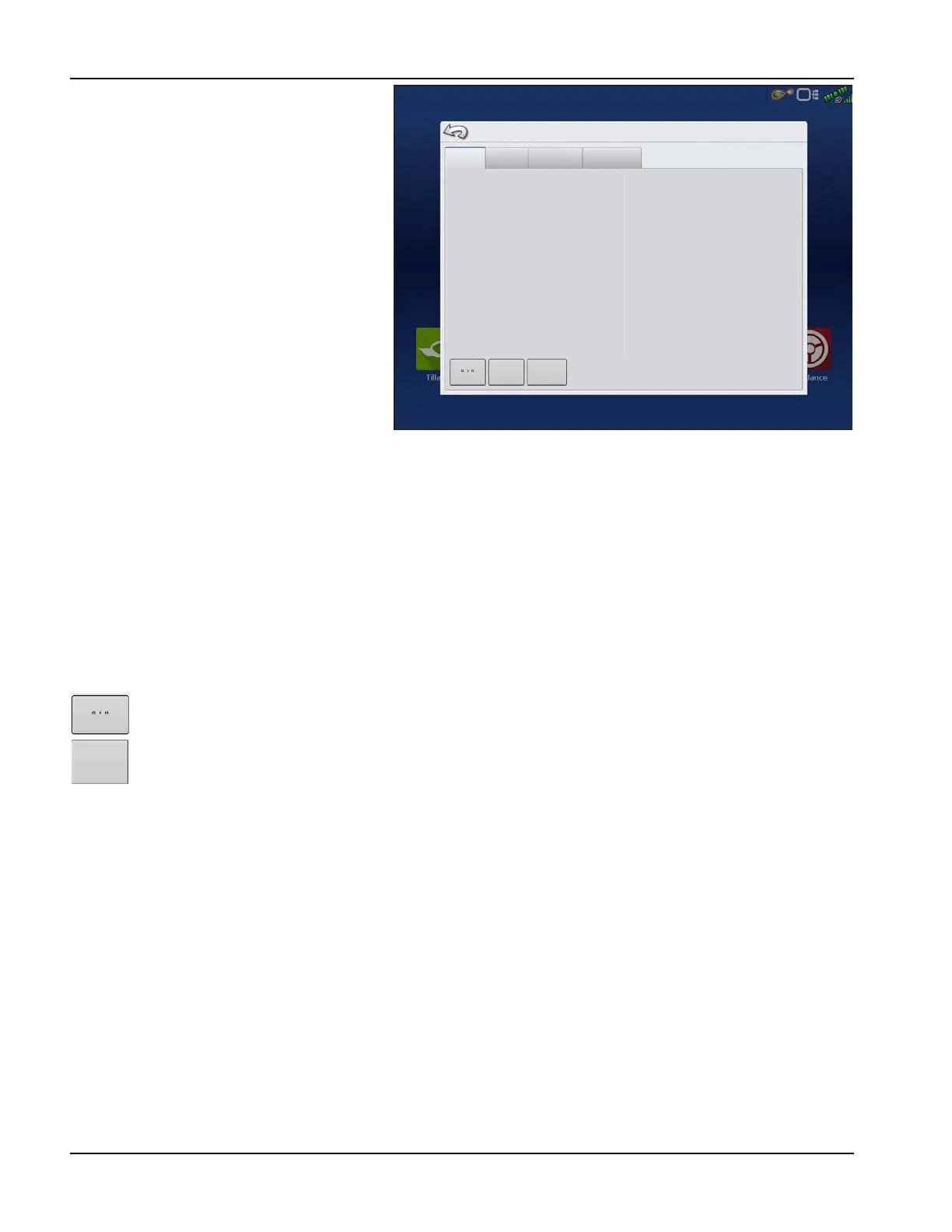
GPS Information
General
Receiver
Differential
Base Station
Latitude
Longitude
Elevation:
Heading:
Number of Satellites:
Differential:
StableLoc Initialized:
GPS Speed:
Position Rate:
Speed/Heading Rate:
42.002605380
-93.628456625
952.142
270.17200
15
RTK Fixed
No
0.00
10 Hz
10 Hz
UTC Time:
UTC Date:
HDOP:
VDOP:
PDOP
Port:
RTK Throughput:
Correction Age:
18:43:05
N/A
1.1
1.3
1.7
8N1
1%
1.00
Satellite
Plot
View
Messages