In-Field Functions
81
PN 4004700–ENG Rev. K
Create Boundary
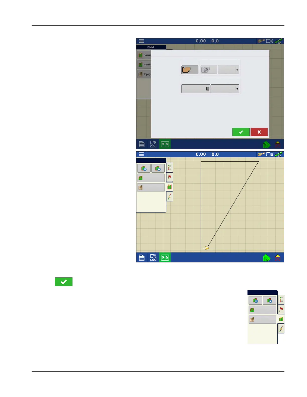
Boundary Settings
Pressing the Start button opens the Boundary
Settings screen.
Underneath the Boundary Type, choose either
an Outer Boundary or an Inner Boundary.
• Outer boundaries delineate the borders of
an entire field.
• Inner boundaries mark specific features
within that field, such as waterways or
buildings.
1. Choose whether to create either an Outer
boundary or Inner boundary by pressing
one of the two Boundary Type buttons.
2. To create an Inner Boundary, use the
Region Type drop-down menu to choose
the type of boundary. Choices include:
• Roadway
• Body of Water
• Waterway
• Buildings
• Undefined
3. The Boundary Offset feature enables
mapping a boundary at a user-defined
distance to the left or right of the GPS
antenna center line. If desired, specify a
Boundary Offset distance by choosing a
direction and distance from the GPS antenna center line.
4. Press to start the boundary.
5. During the creation of a boundary, the Pause/Resume button and Stop button appear at the top
of the Field tab.
6. Press the Stop button to complete the boundary. At the Boundary screen, choose whether to
Save, Resume or Discard the boundary.
Pause Boundary
When creating a boundary, use the Pause Boundary button to create a straight line between two
points. To do this, drive the vehicle to a point, press the Pause Boundary button, then drive to the
second point. Press the Resume Boundary button to create a straight line between current point and
pause location.
Boundary Settings
Boundary Type
Outer
Inner
Region Type
Undefined
Boundary Offset
0
Distance
Left
Direction
Field
Headlands
Topo gra phy