46
Manage Data—Share InCommand data, free
up hard drive space, and manually sync items.
÷
NOTE!: Data synced from SMS cannot be sent out of AgFiniti Mobile using the Send To tool.
AgFiniti Essentials - Cloud Sync
With an AgFiniti Essentials license, all data and maps are synced so that data is always available using AgFiniti Cloud or
AgFiniti Mobile. Data can come from:
• Ag Leader InCommand data synced with AgFiniti Mobile
• Ag Leader InCommand or legacy (Ag Leader Integra or Versa) displays using wireless file transfer.
• Any AGDATA file manually loaded into AgFiniti Cloud
• SMS - Most SMS data can be exported to AgFiniti (including soil survey data, soil sampling sites, and data from 3rd
party displays)
Once data has been synced to AgFiniti Mobile, an active internet connection is no longer needed, and maps can be viewed
anywhere. Once the data is present in the app, it can be utilized just like data synced directly from an InCommand display.
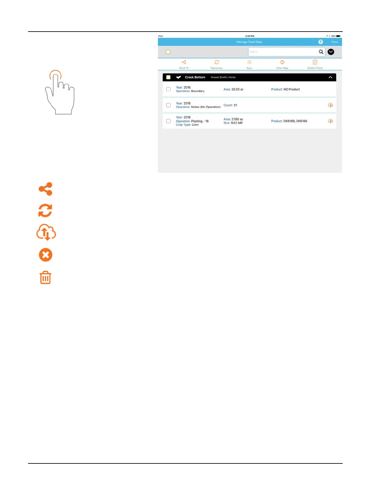
Use the tap gesture to
make selection.
To send data via email or third party sharing app, select the appropriate data and tap on the Send To button.
Due to size limits, only one fields worth of information can be sent from within the app at a time. Multiple
fields can be shared at once using AgFiniti Cloud.
View a previously cleared map, choose the desired data and tap Reprocess.
To manually sync data between AgFiniti Mobile and AgFiniti Cloud, select the desired data and tap Sync. To
make this happen automatically, see “AgFiniti Essentials - Cloud Sync” on page 46.
Maps are automatically processed and displayed upon import. Use this option to remove data from maps
and reports (to free up space) but keep InCommand files available for sharing.
The delete button will remove specific maps and data completely from AgFiniti Mobile. To use this option,
use the Clear Map button first and remove processed maps.