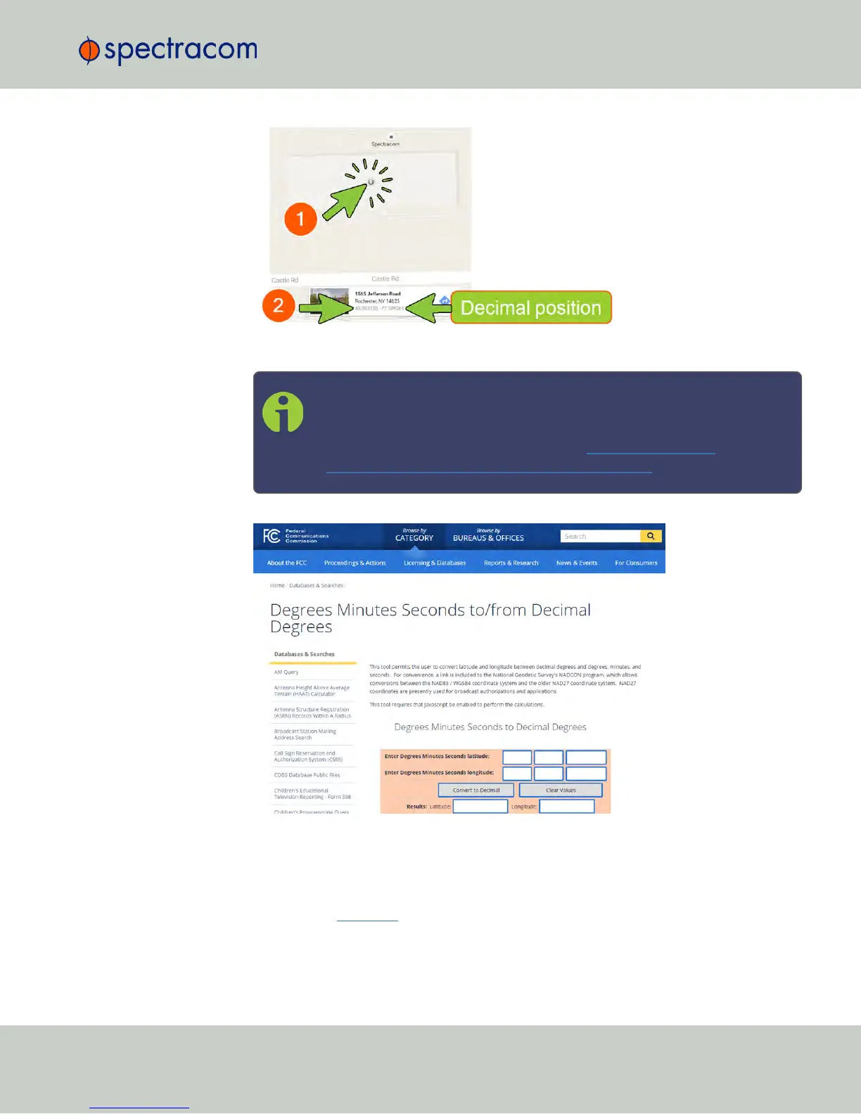
3.
Take note of your decimal position.
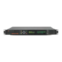
Note: Should you prefer to determine your position in a different way,
and as a result, have your latitude & longitude data in degrees/minutes/
seconds, you need to convert this data e.g., by using a conversion tool,
such as Earth Point www.earthpoint.us , or
https://www.fcc.gov/media/radio/dms-decimal:
4.
Determine your altitude: Finding the altitude of your NetClock's antenna position is not
as crucial as finding the latitude and longitude. Looking up the altitude for your general
area will suffice for most applications.
If a more exact altitude is desired, the use of a topographical map is recommended.
Applying the WGS 84 standard will likely yield the most accurate elevation.
5.
Click Submit to apply any changes you may have made.
3.3 Managing Input References
CHAPTER 3 • NetClock User Reference Guide Rev. 16
201