Applications
B2-6 ENVI-MAG Manual
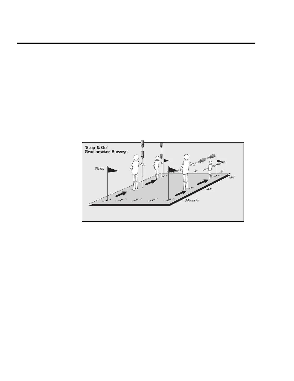
Gradiometer
You can also perform the survey using the gradiometer mode. The
gradiometer survey is carried out using two vertically spaced sensors;
usually one metre (3 feet). The magnetic field reading is taken for each
sensor and the difference is divided by the distance. The measured value of
a gradiometer survey is expressed as nanoTeslas per metre (nT/m). This
mode has the advantages of being totally independent of time-based
variations, since it measures a difference in magnetic fields. However,
especially for environmental applications, it is more sensitive to near-surface
objects, which can be a disadvantage. The following figure (Figure B17)
illustrates the set-up for a gradiometer survey.
Figure B17 Set-up for a gradiometer survey in the Stop-and-Go mode.
Field observations
Finally, to help in the interpretation of the final data, it is very important to note
all possible sources of noises, i.e. cultural features, encountered during your
survey. When you are examining the data after it has been plotted, the ability to
correlate known noise sources with the anomalies on your map greatly aids in the
proper identification of the buried targets.
 Loading...