Menu Reference
ENVI-MAG Manual C3-19
Reference
This group of options controls the reference grid options such as annotations and
station symbols.
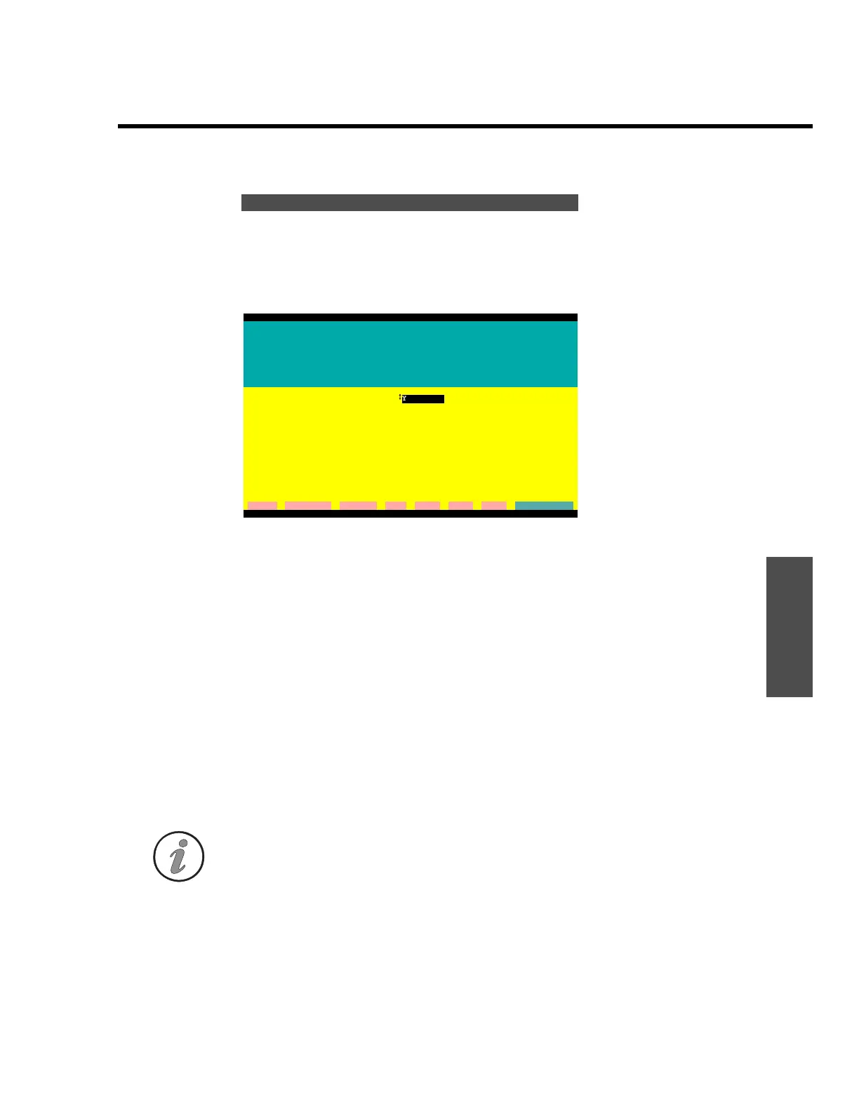
Figure C-17 Reference grid dialogue screen
Reference Grid
A reference grid can be overlaid on the plot to provide a ground
coordinate reference.
1. Show Reference Grid?
A YES or NO option.
2. X-spacing
3. Y-spacing
By default, the system will automatically determine a suitable
spacing between grid lines. If the selected spacing is not suitable,
you can specify your own in ground units.
Note: If you select a spacing that is too narrow, the grid annotations may overlap.
Reference grid options
ENVIMAP Version 3.02.00
REFERENCE GRID
A reference grid can be overlayed on the plot to provide a
ground coordinate reference. Station markers may also be
plotted. Station markers are symbols plotted on the map to
show the location of readings.
Show a reference grid?
YES
Reference grid X spacing:
Reference grid Y spacing:
Add compass direction suffix: YES
Grid format: dotted lines
----------------------------------------------------------------------------
Show station markers? YES
Marker symbol: +
Marker size (mm): 1.5
cleaR clear All Command Dos Help List eXit Go
G:\ENVIMAP
 Loading...