Survey do’ s and don’ ts
ENVI-MAG Manual B3-9
Example
Rough terrain
You may find that in certain circumstances, such as sloped terrain where
progress is much slower than on flat terrain, it is quite difficult to maintain
the same station density — as you slow down, more data is being collected
over the same amount of lateral coverage as on level terrain. To even out this
coverage, you can specify a longer cycling time (greater than the 0.5 seconds
you have chosen, for example). Alternatively, you can introduce an addition-
al delay in the cycle time, (the “CYCLE DELAY” feature), prolonging the time
interval between readings and allowing you to maintain a more even cover-
age of your grid.
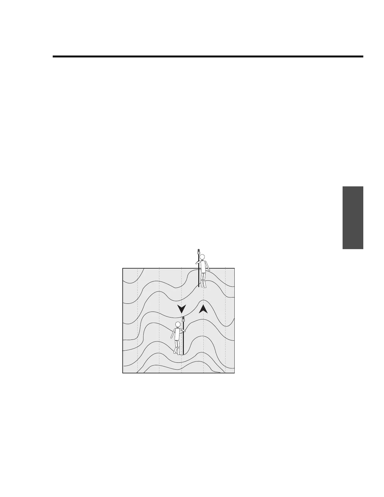
Station lag and Herring-boning
The measurement that you make with the ENVI-MAG does not take place im-
mediately due to the cycle time of the instrument, which is at best 0.5 sec-
onds. Consider also, that during a WALKMAG survey you, the operator, are
continuously moving. Is there going to be a problem when you change direc-
tions? With some other instruments, this inherent lag in the data would cre-
ate very distinct herring-bone patterns in the contoured data, as illustrated in
the following figure (Figure B-24).
Figure B-24 Typical herring bone patterns in contoured data.
This pattern is present to some degree in all surveys with continuous data
collection, where the sensors and instruments are not exactly spatially
coincident. To minimize any problems, the internal software in the
ENVI-MAG automatically tries to correct this lagging phenomenon.
 Loading...